The Wave: Arizona's Hidden Gem
Scroll DownThe Wave is a uniquely popular and unpopular destination. It’s possible to go most of your life without knowing it’s even there, but once you find out, you join a large group of people trying to go there.
Trying is the key word here. The Wave and the land around is is fragile territory, and allowing too many people to visit it would quite literally destroy it. It isn’t unique in that sense, but what makes it unique is the mind-boggling amount of people applying for permits, and how many of them actually get them.
Every day, 20 people are allowed into The Wave.
Half of those get their permits via an online lottery. You apply for an online permit 3 months before the day you want to hike, giving plenty of time to take time off from work and figure out how to get yourself to this rural bit of land. The other 10 permits are given out based on an in-person lottery done the day before at a government office in Kanab.
In 2017, over 160,000 people applied for permits and 7,300 were handed out.
Two of those went to my friend Stef and I.
🚘 Getting to The Wave
Las Vegas, mid May. I don’t like gambling, I don’t like huge parties, and I don’t like overpriced food. What I mean is, I really don’t like Las Vegas. However, Vegas is a perfect jumping point for some of the best nature in the country so I find myself flying into it semi-often. It’s hard to feel any more out of place than being on a plane full of vacationers with your tent, hiking poles, and dehydrated food.
Being such a large city, Vegas always has cheap rental car options, which helps significantly with planning trips on a budget. After I met up with Stef we picked up our rental car and immediately hit the road. We had a half day to buy any supplies we needed and do the ~4hr drive from Vegas to the trailhead. Once there, we could set up our tents and start hiking in the morning before the other 18 people for the day arrived.
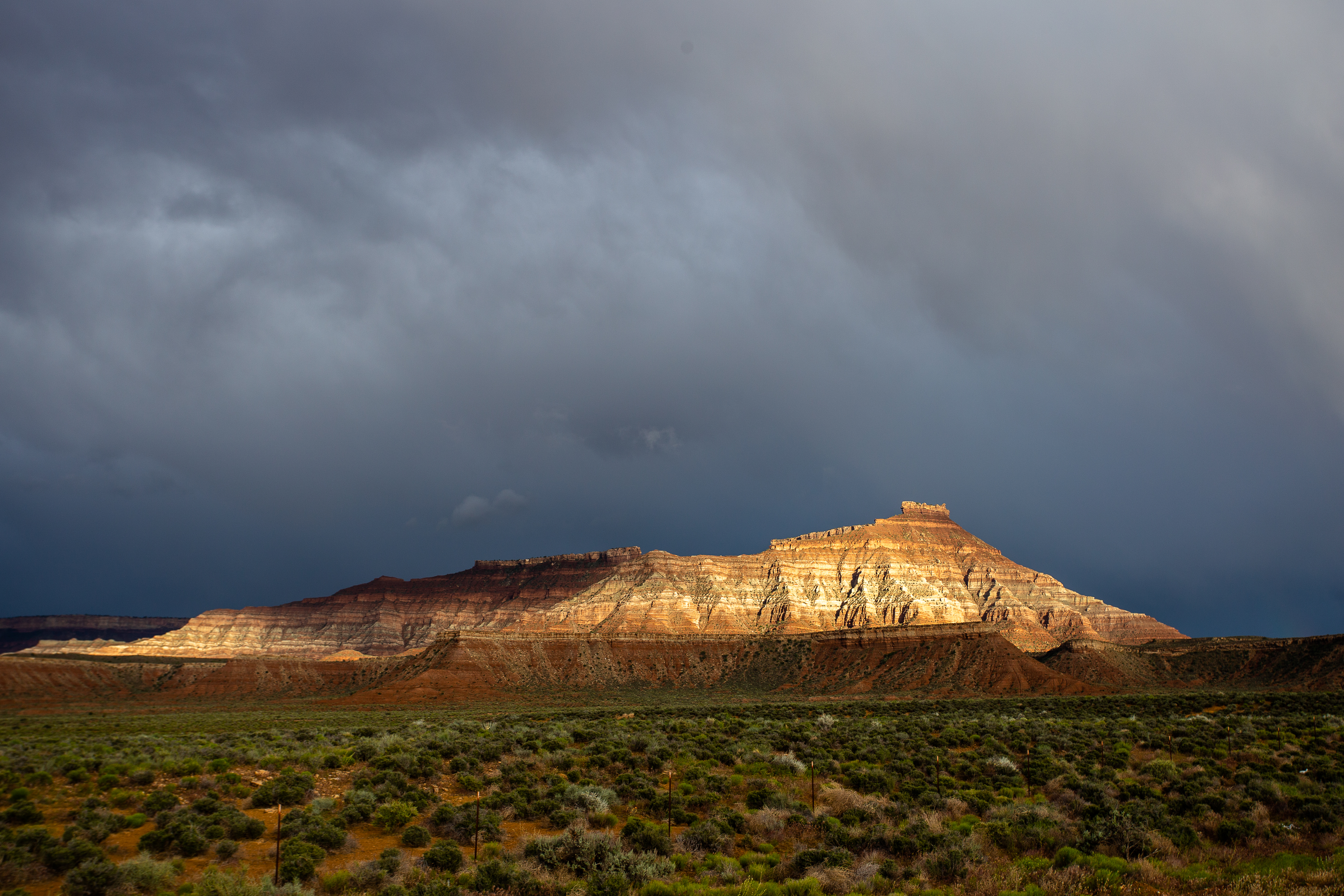
Everyone knows that Vegas is in the middle of a desert, but it’s hard to really grasp that until you drive out of the city. There’s really nothing out there, and the land slowly began to morph and change into something strange and surreal as we drove northeast. It had rained earlier in the day, and beams of sunlight stabbed through the dark clouds to illuminate jagged slabs of sandstone in the distance.
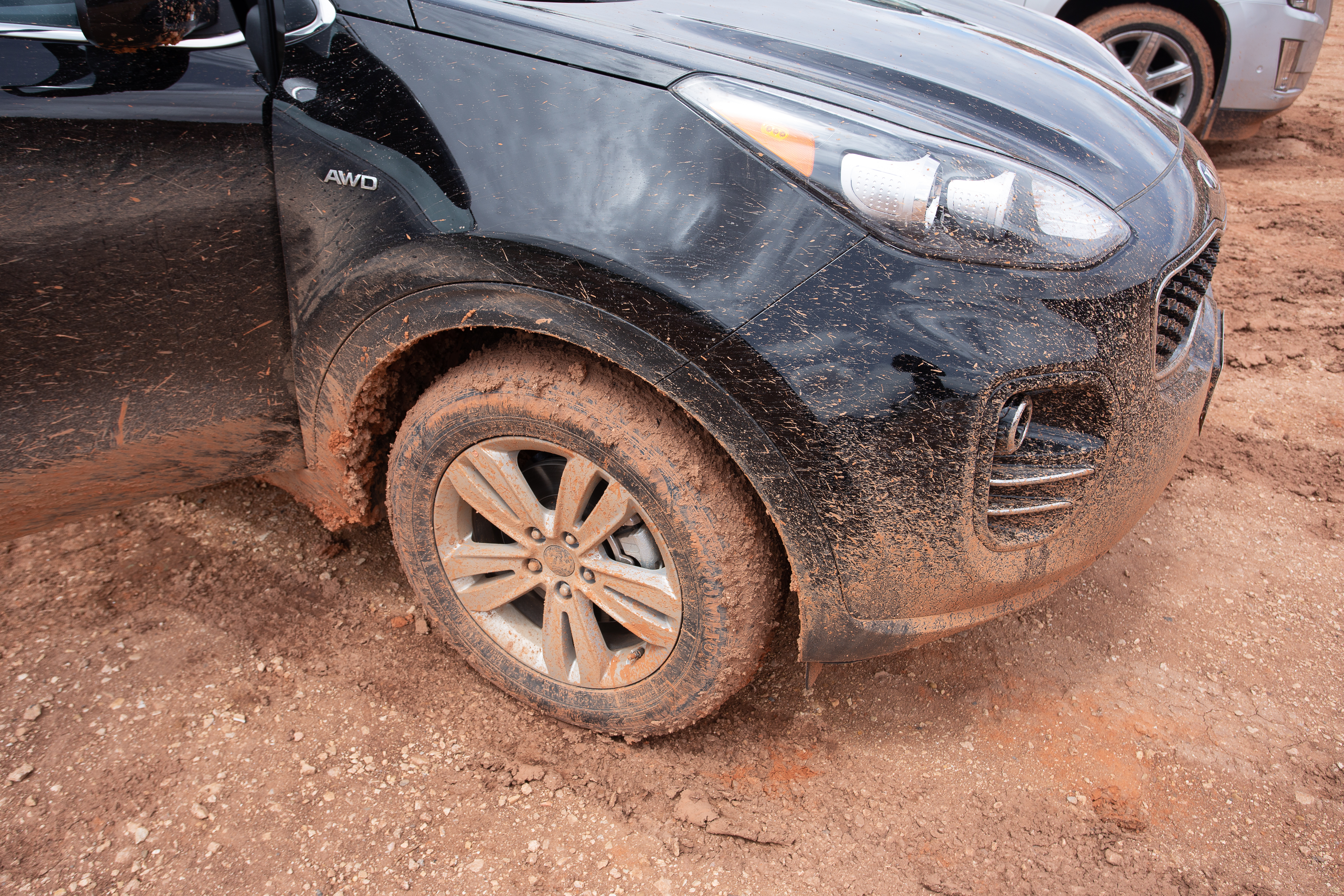
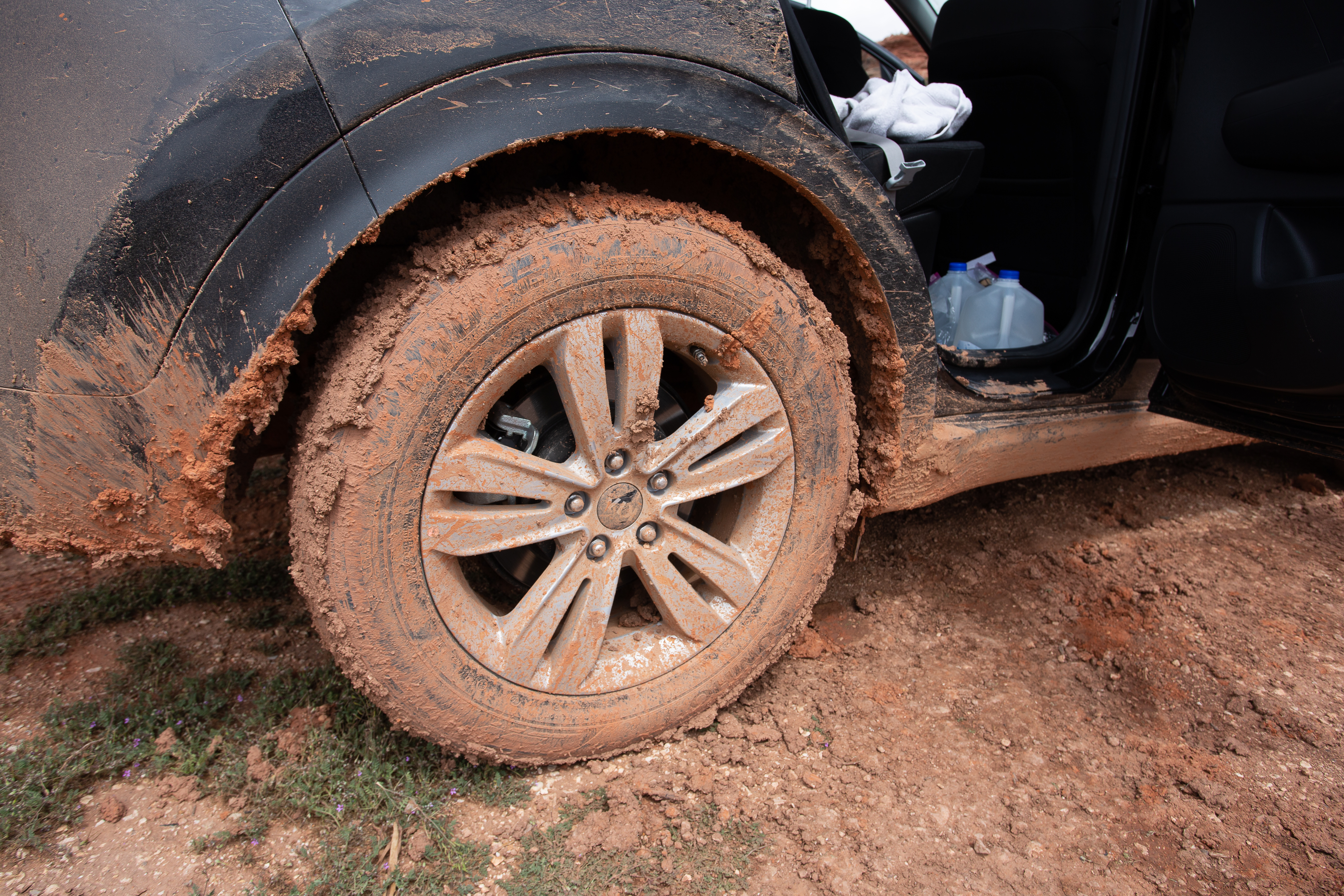
Towards the end of the drive, there’s a turnoff to House Rock Valley Road. This little stretch of road is one of the many challenges between The Wave and the rest of the world - it’s all unmaintained dirt, and the recent rain had liquified most of it. Every minute or so the car would jolt to one side when a wheel would hit a giant rock hidden under the mud.
We had to do this entire part of the drive in pitch darkness, and with the road being so uneven, our headlights rarely reached more than 10 feet in front of us. Every time we had to make a sight turn, the rear wheels would go skidding in the opposite direction, and our brakes may as well have been useless since the car had so much momentum.
Think about this the next time you see a sign saying “Road impassable when wet”.
Even walking around the car was a hassle. You only needed to take a few steps for your shoes to get caked in the mud. It wasn’t even normal mud - there were large clumps of solid dirt and grass suspended in it. It all seemed to be glued together. Even after kicking the tires vigorously, you would still have a few pounds of mud and dirt on each shoe.
Setting up our tents was clearly not going to happen. We folded down the back seats and slept in the car for the night.
🌊 The Wave
By the next morning, everything had dried and solidified significantly. We crawled out of the car and immediately got to cooking up breakfast and packing our bags for the hike.
There is no trail to The Wave. The permits for the area aren’t even for The Wave itself, they’re for the north section of an area called Coyote Buttes.
Coyote Buttes is part of a larger protected wilderness area. There’s an important distinction here between being in the wilderness and just being in nature. 4.5% of the entire United States is wilderness, and the law defines that as: “an area where the earth and community of life are untrammeled by man, where man himself is a visitor who does not remain.”
What that means is that in almost all wilderness areas, there are no signs. No toilets. No benches to sit and take in the view. And no trails.
From the lot we parked in, there’s a short path to Wire Pass and Buckskin Gulch (more on that later), and after walking down it for a few minutes, you can step off into the Coyote Buttes wilderness.
The Wave is about 3 miles into Coyote Buttes, and people have put in some effort to make sure folks don’t get lost - someone marked out a virtual trail on Google Maps, so you could save the area to your phone and follow those directions since GPS doesn’t require phone signal (and you won’t have one). Most of the time, I believe there’s are stacks of rocks you can follow to get there.
However, Stef had done some research beforehand and assured me he had foolproof instructions. I didn’t know any more than that, but once we’d stepped into the wilderness I decided to ask.
“Well,” he said, “what I read was that if we walk mostly straight, it’s right behind a big rock formation that looks like a butt crack.”
Perfect.
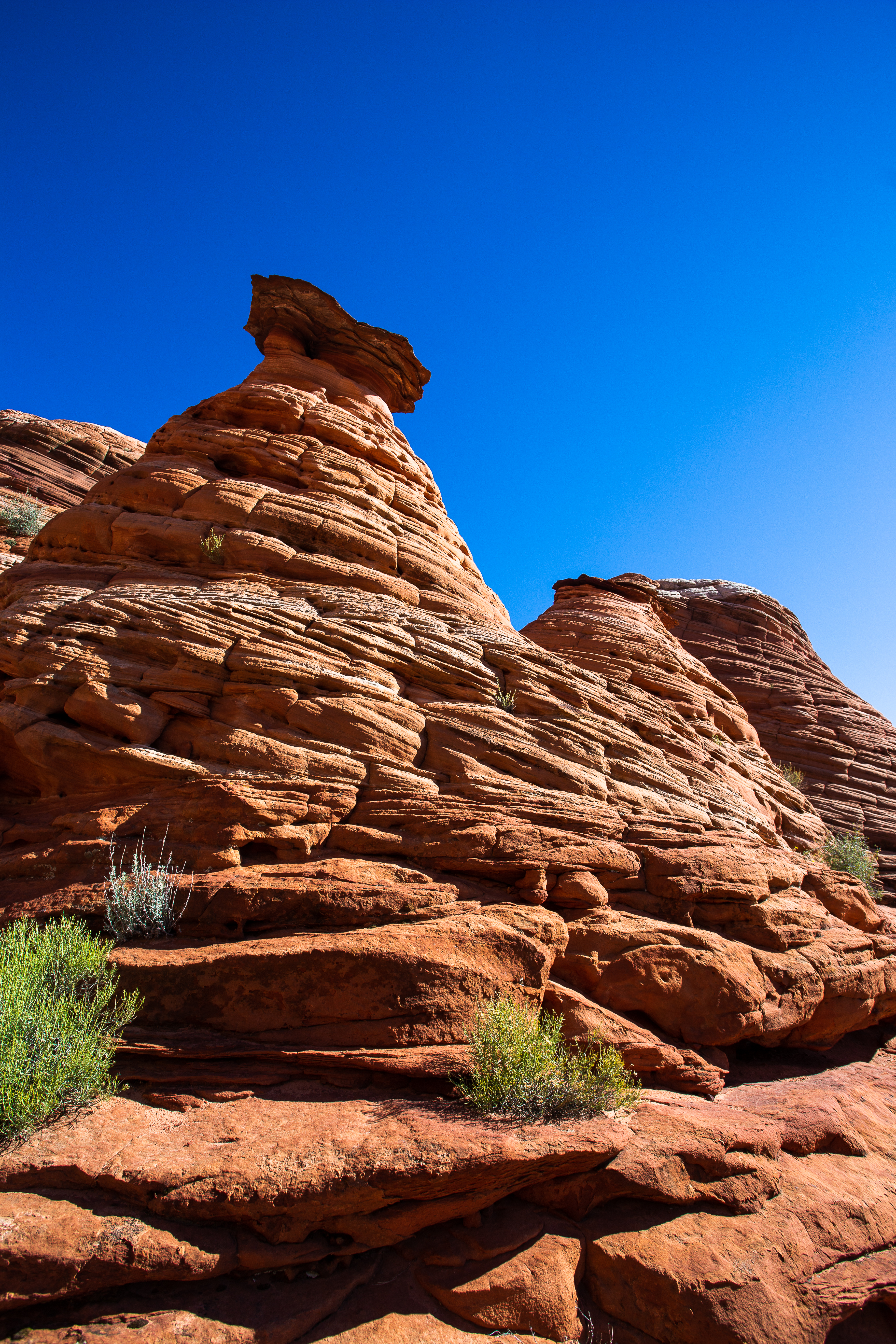
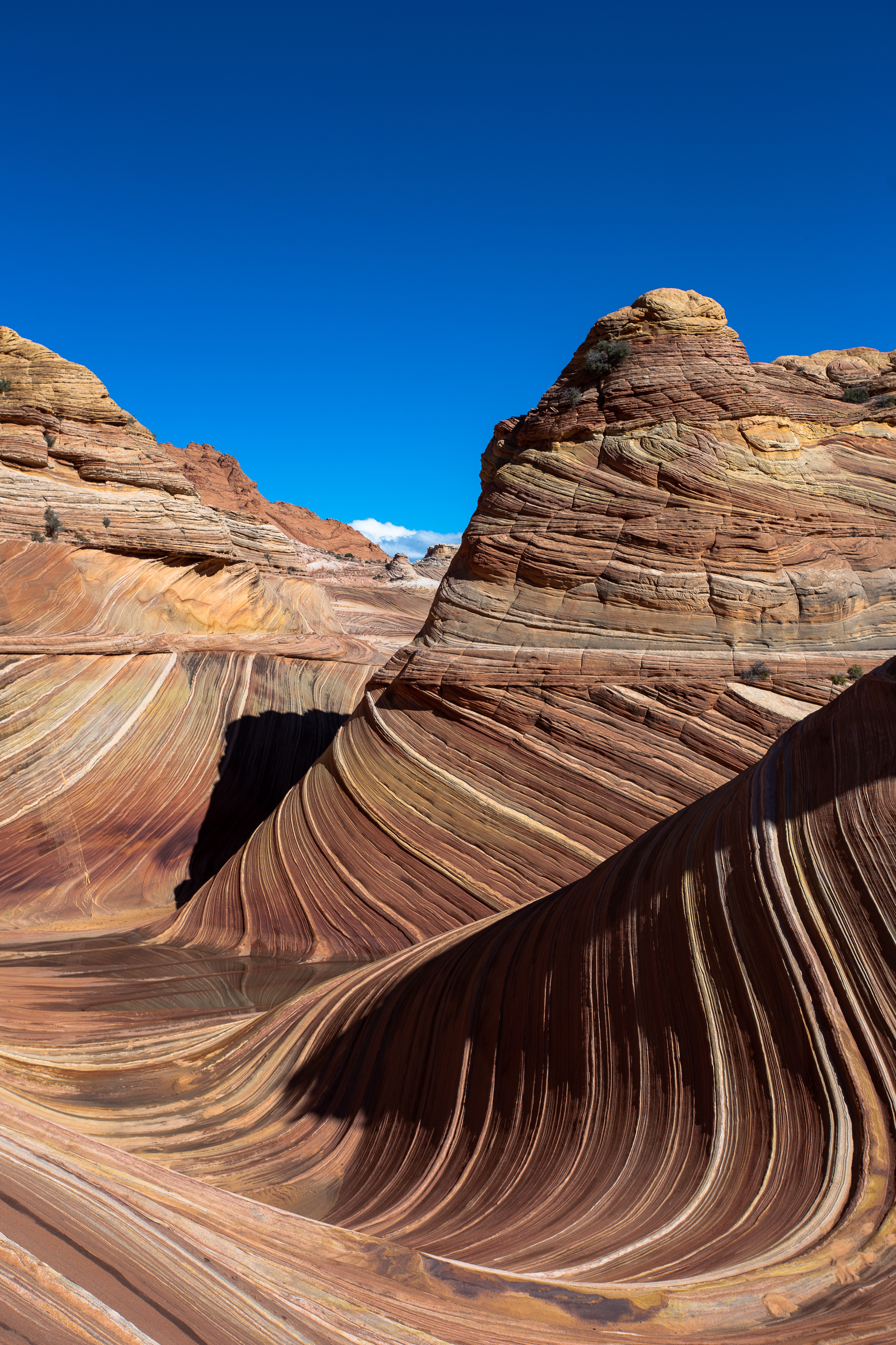
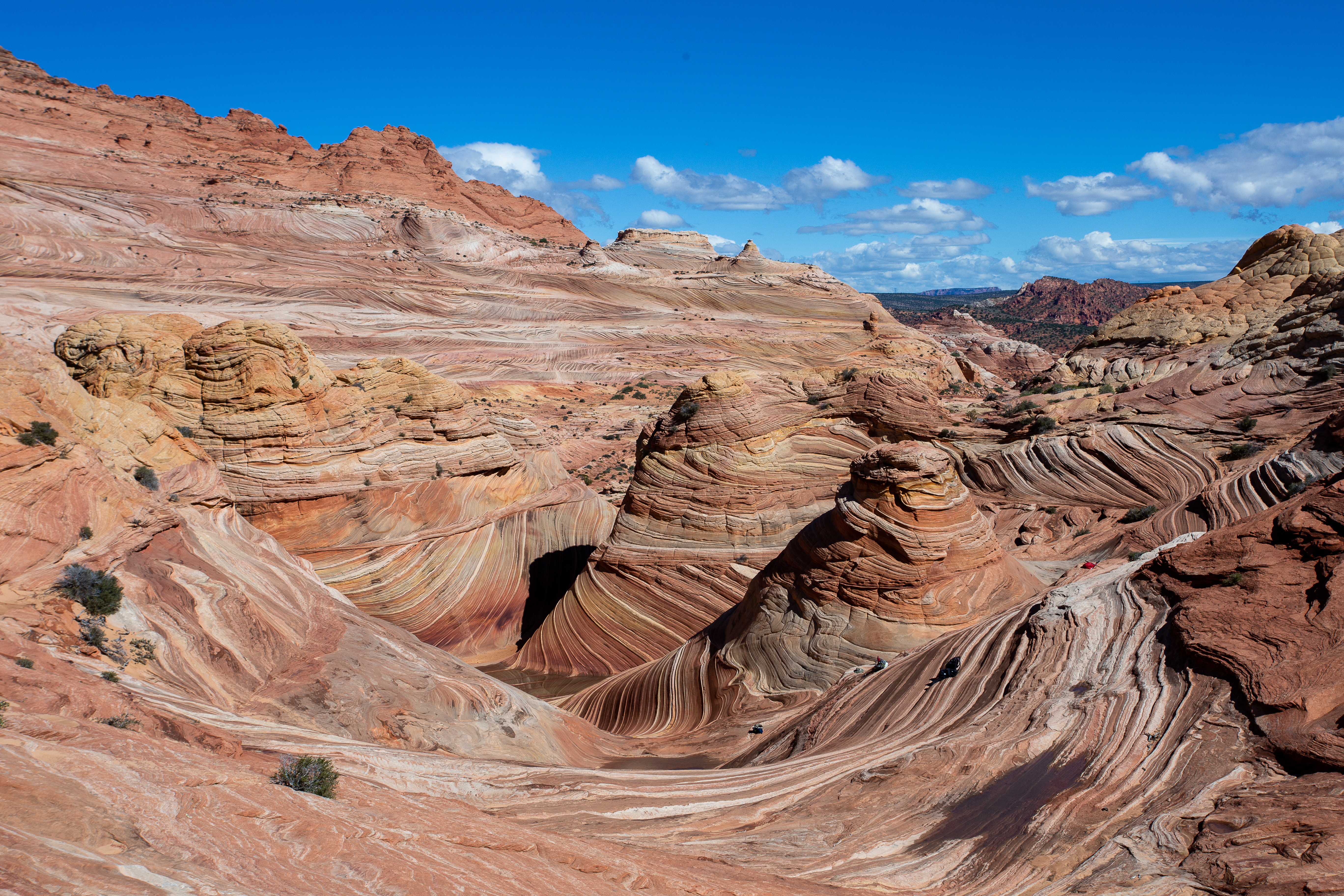
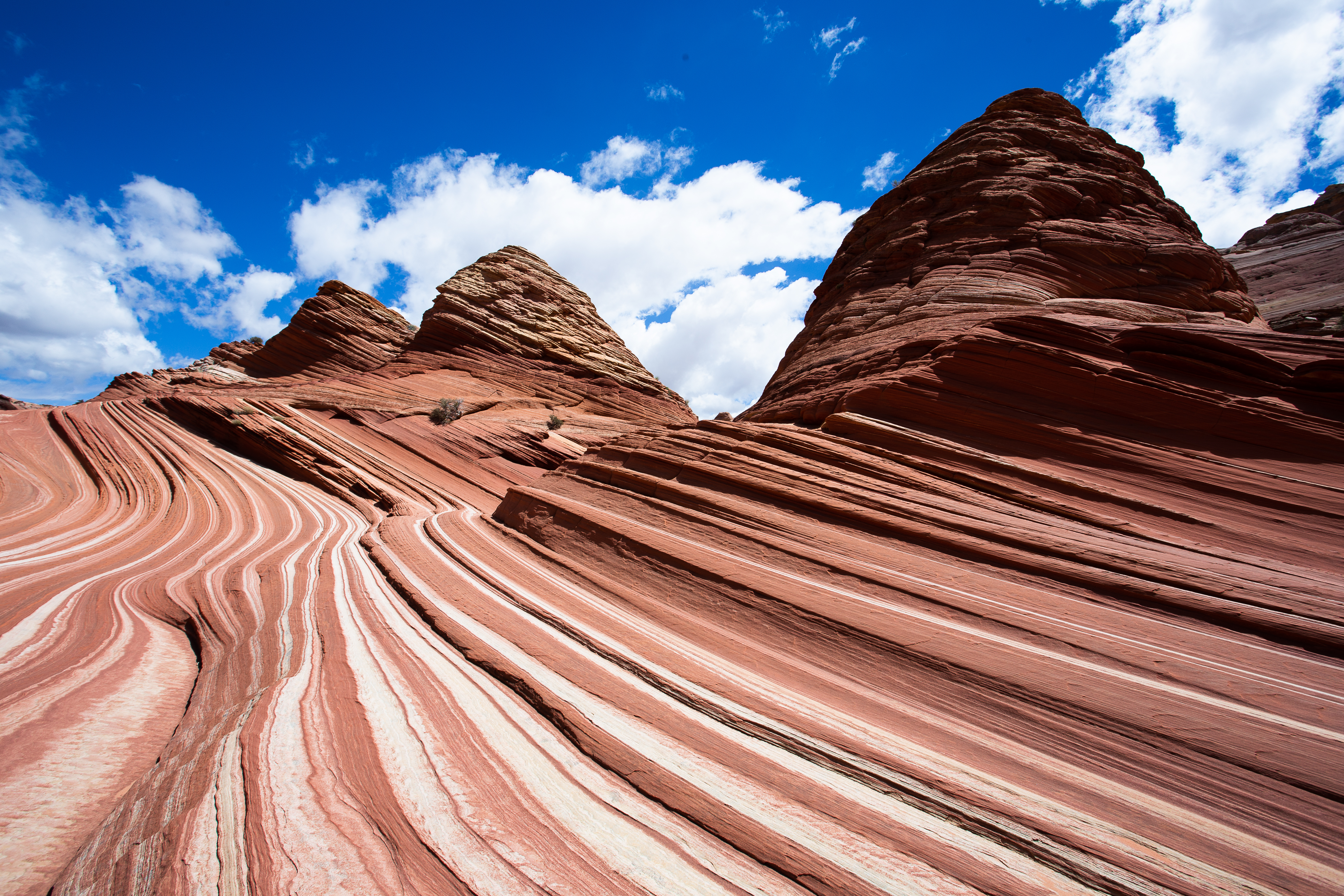
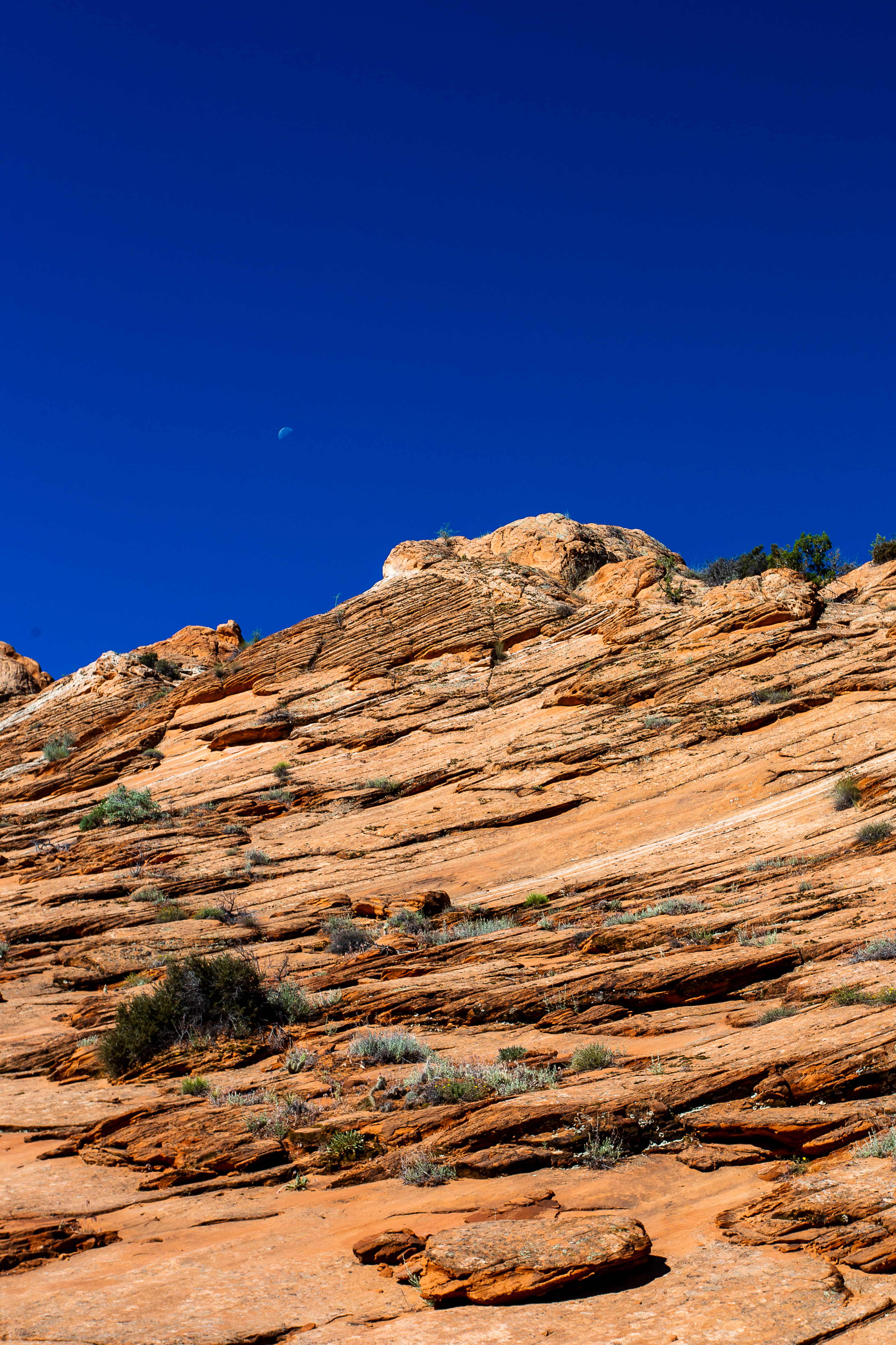
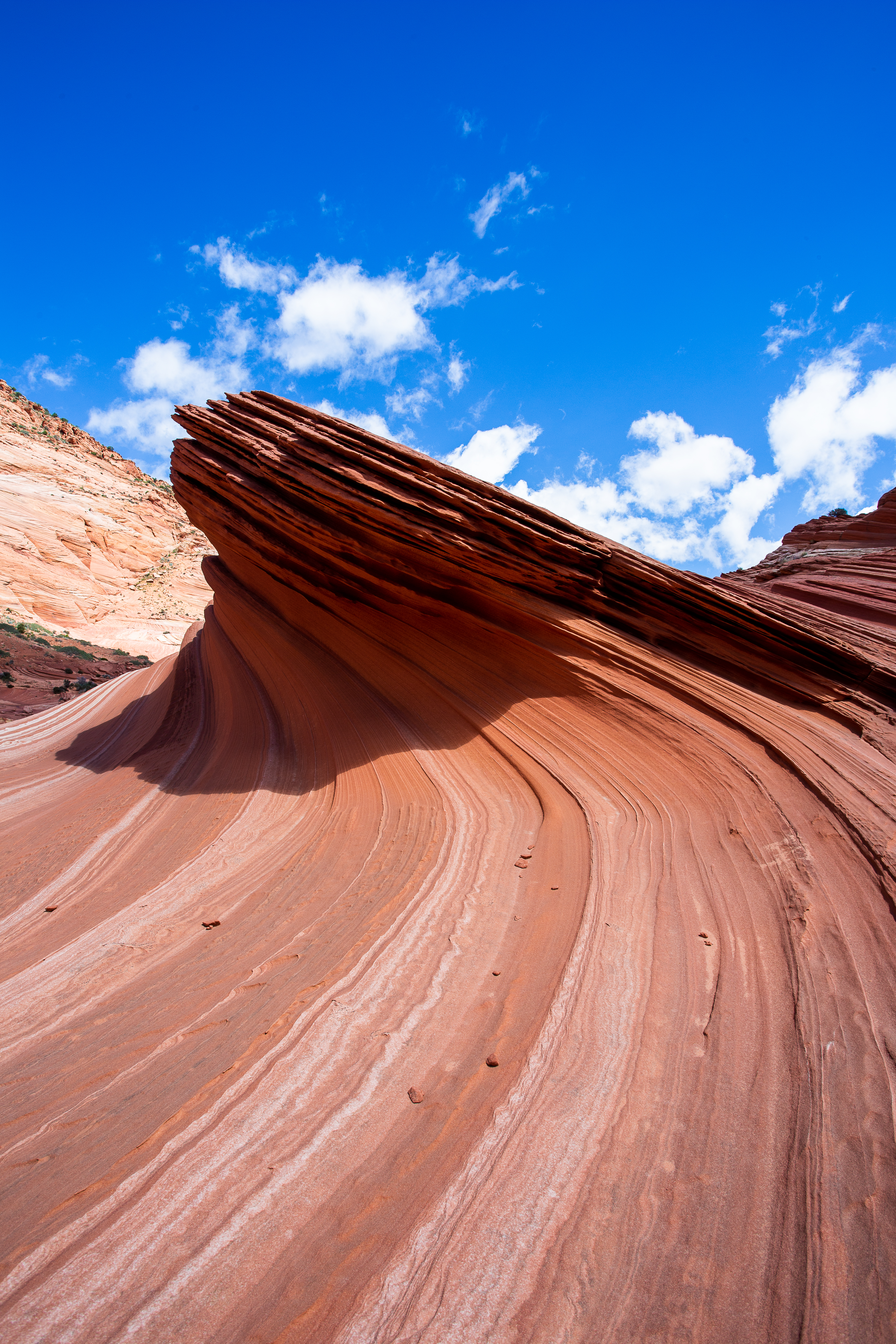
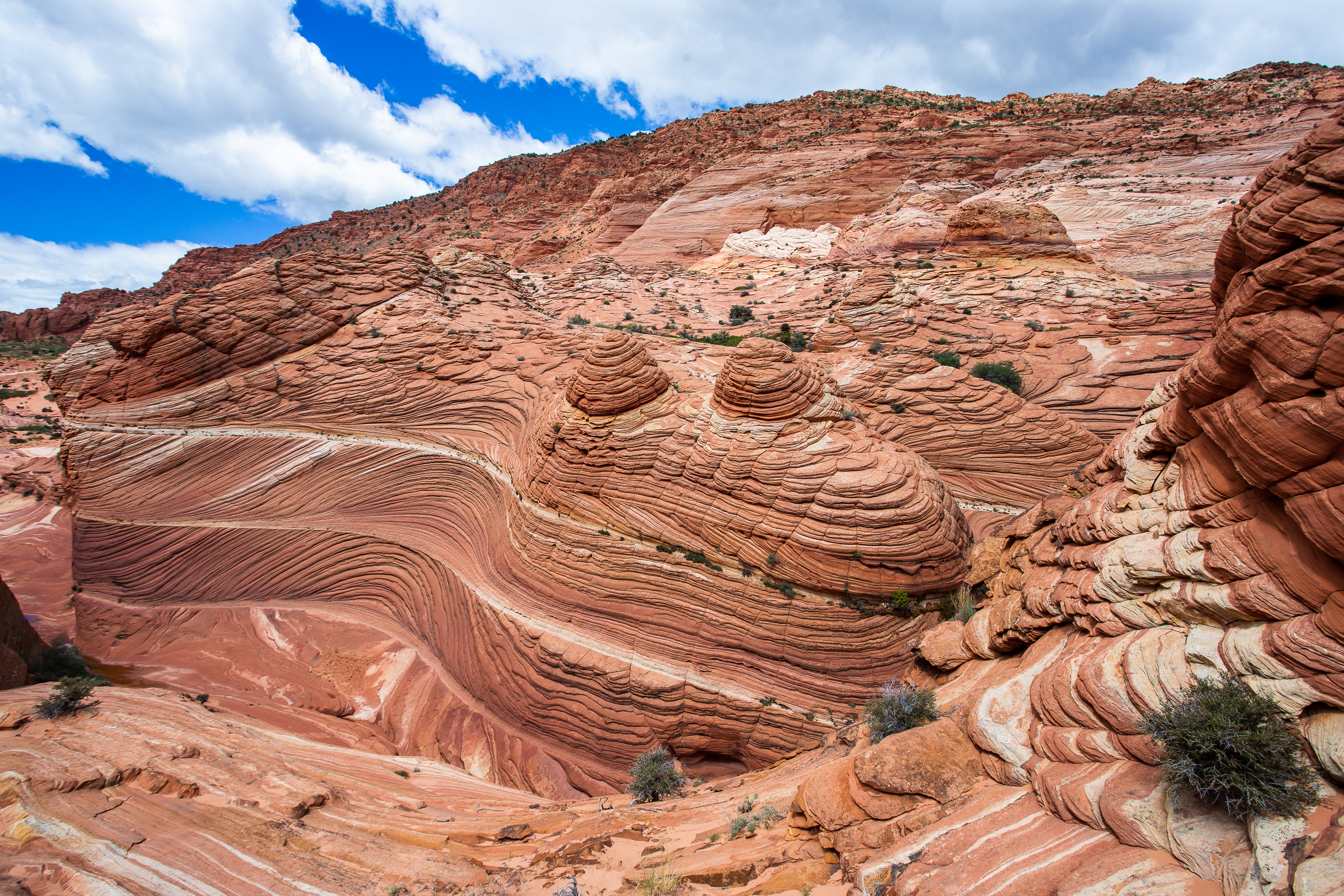
Coyote Buttes is gorgeous. It’s quickly apparent that the entire area is full of surrealist rock formations. After the first mile, you’ll find yourself in a reddish-orange Dr. Seuss landscape.
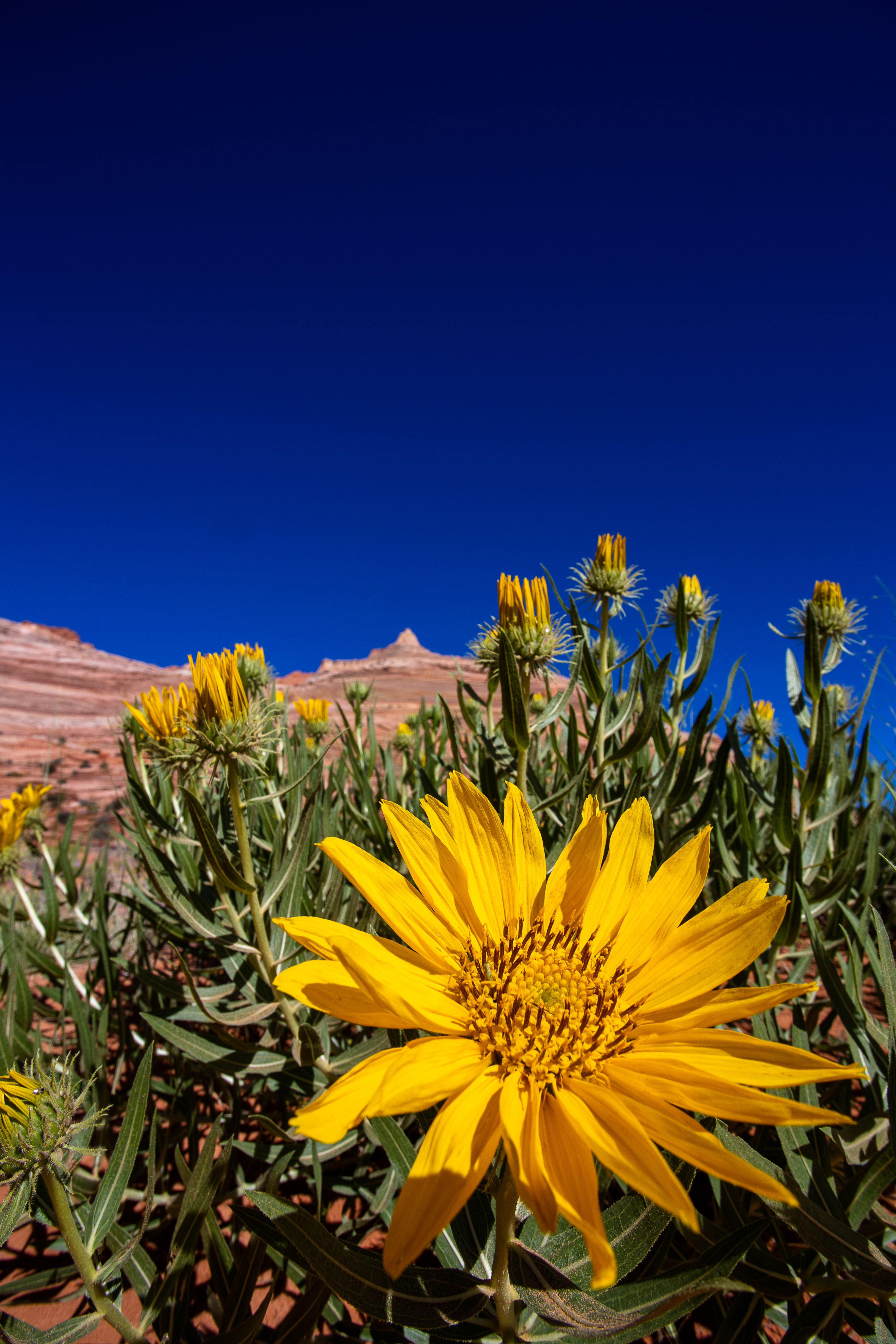
The region is a desert, but it’s a rocky desert. There are no water sources, but there are plants. Hardy shrubs and marigolds aren’t common, but definitely thriving.
It’s impossible to walk in a straight line, but true to Stef’s word, there is a giant rocky butt crack right next to The Wave, and you can clearly see it after walking through Coyote Buttes for a bit.
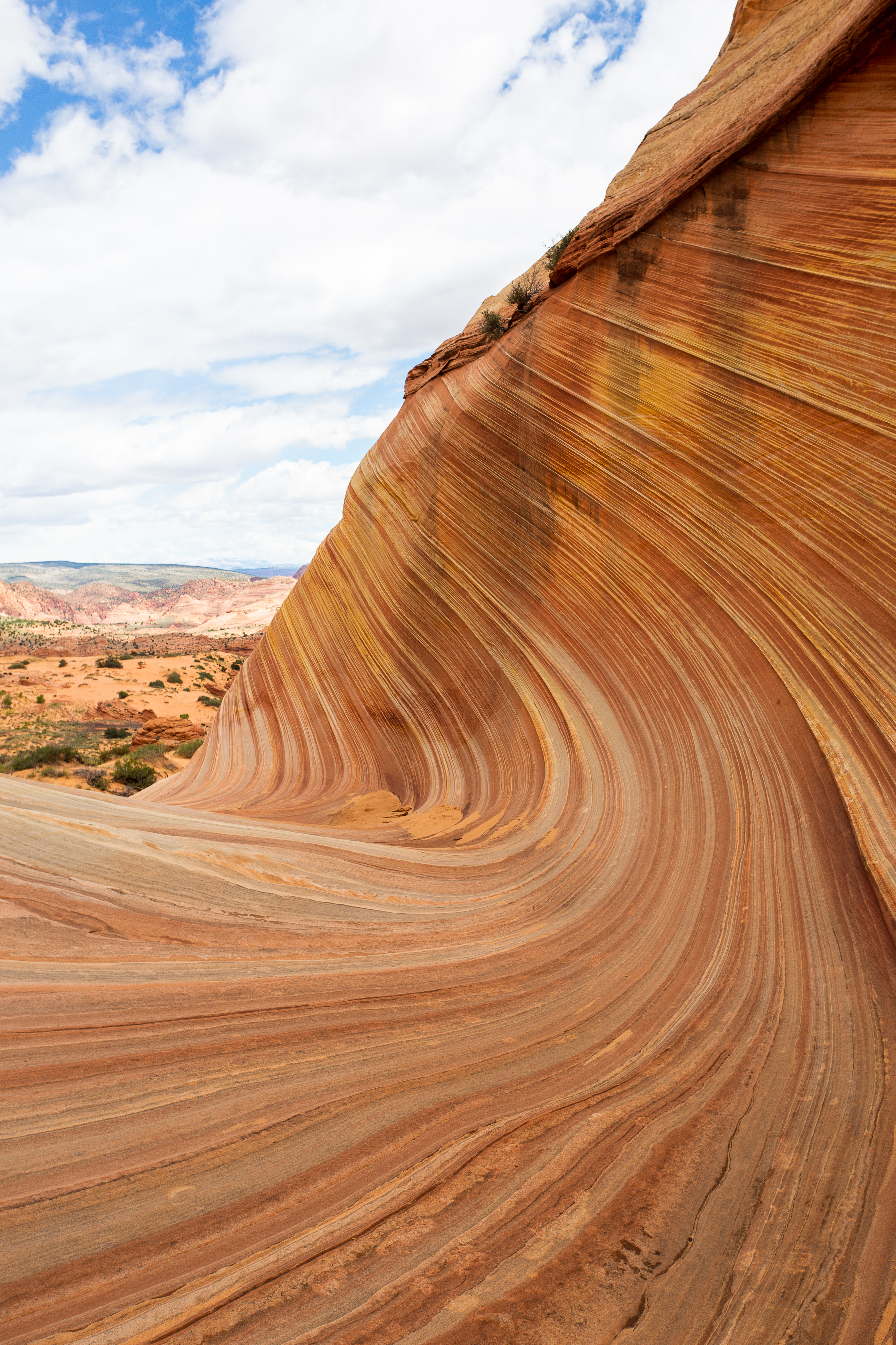
Arriving at The Wave is a surprising moment - it’s very easy to walk right past it since the appearance dramatically changes depending on where you’re looking at it from. To see the angle that almost all the photos are taken from, you need to walk across the entire formation and turn around. Stef and I actually walked right past it before hitting a dead end and noticing it after turning around.
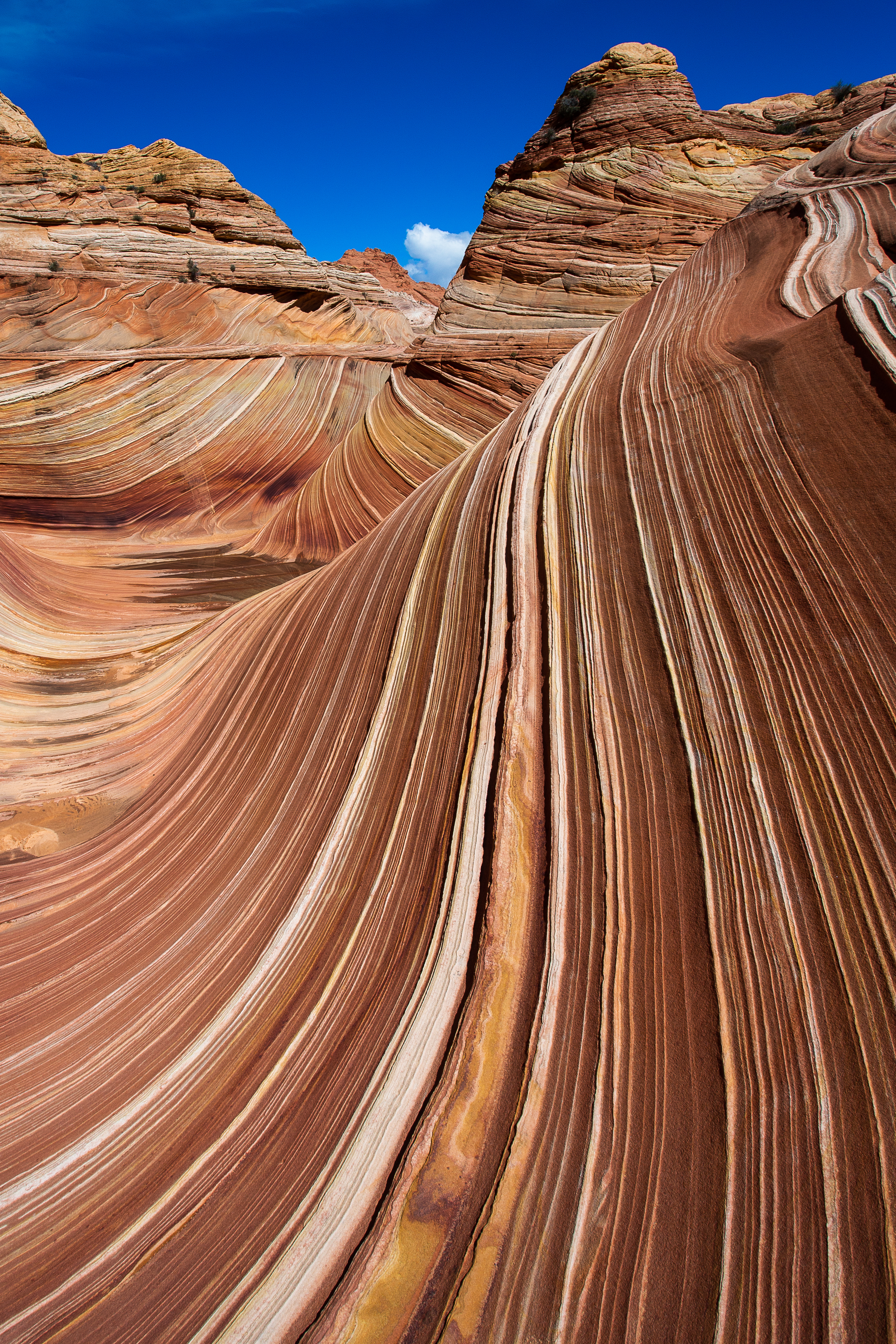

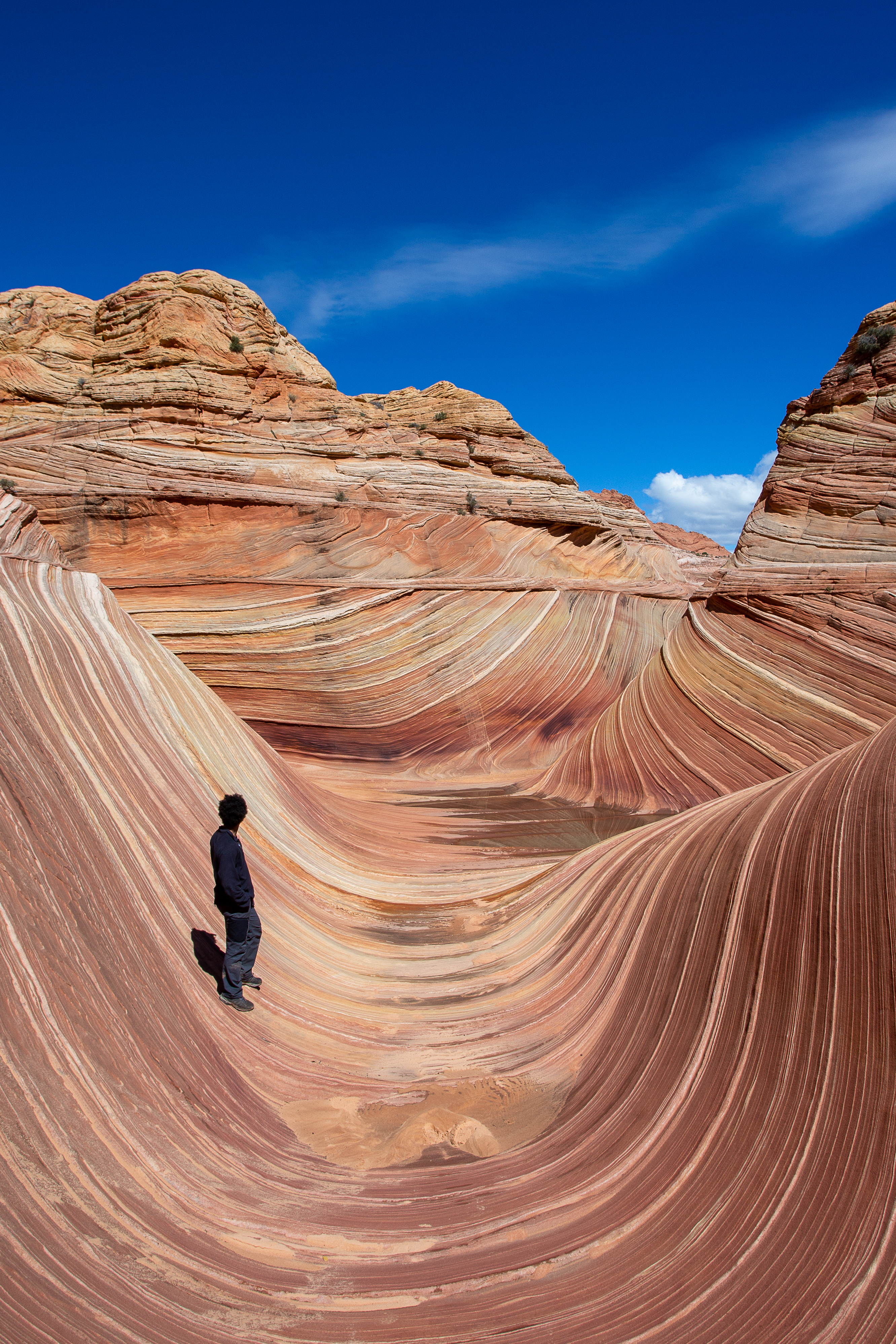
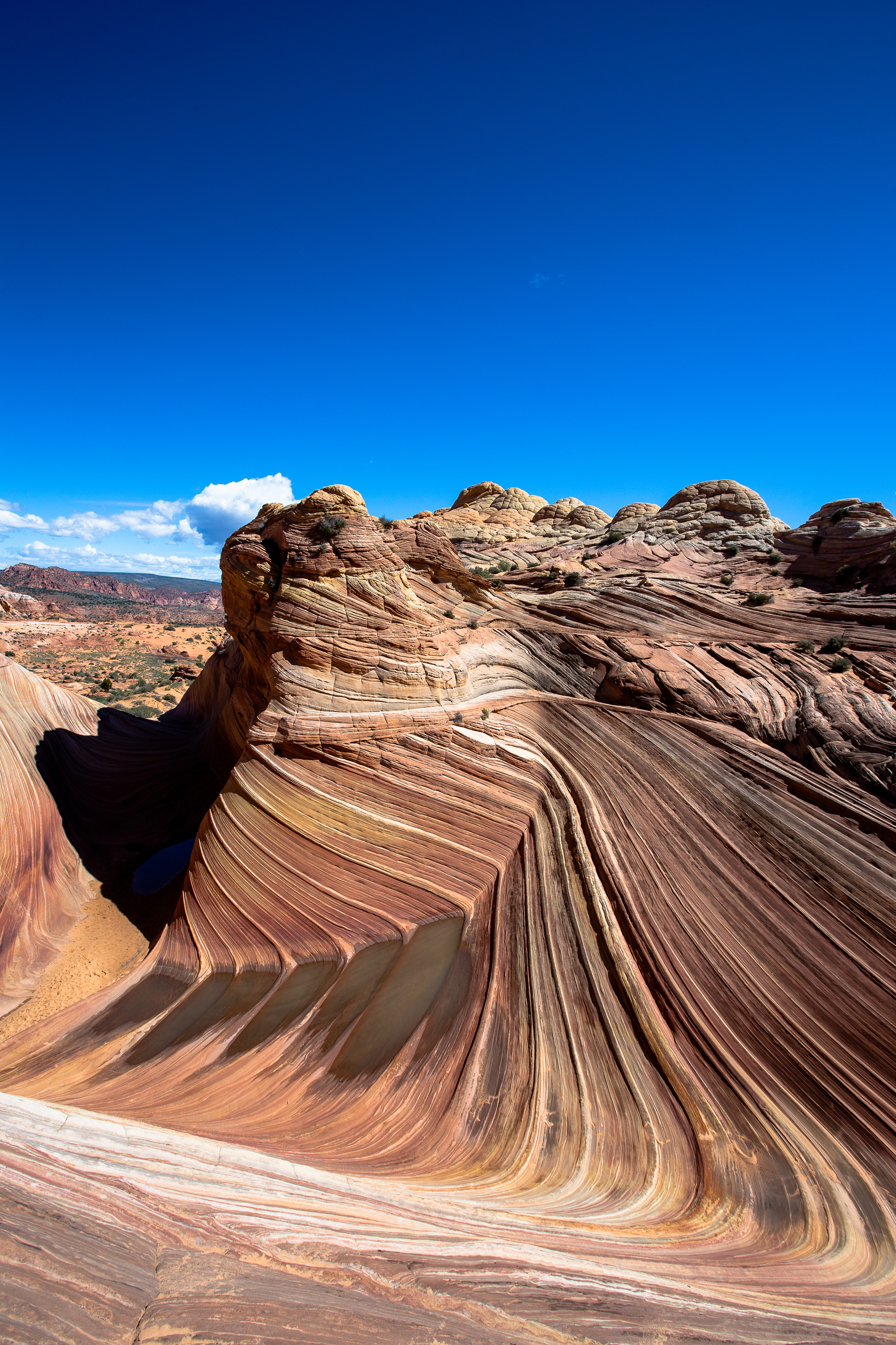
We were the first people to arrive there that day, and were lucky enough to have it to ourselves for about 45 minutes. You might notice some dark spots near the bottom of The Wave - sometimes after a strong rain, clear puddles will be left behind and provide beautiful reflections of the curving walls around them before evaporating. No luck that day - we only got a few dark pools of water.
Coming back here is very high on my to do list. Not just to see The Wave again, but also to explore more of Coyote Buttes. We spent some time looking around and while we didn’t find anything as large as The Wave, we did find plenty of otherworldly formations. If you come out here with a backpack of water, a map, and the skills to use it, you could have a fantastic time.
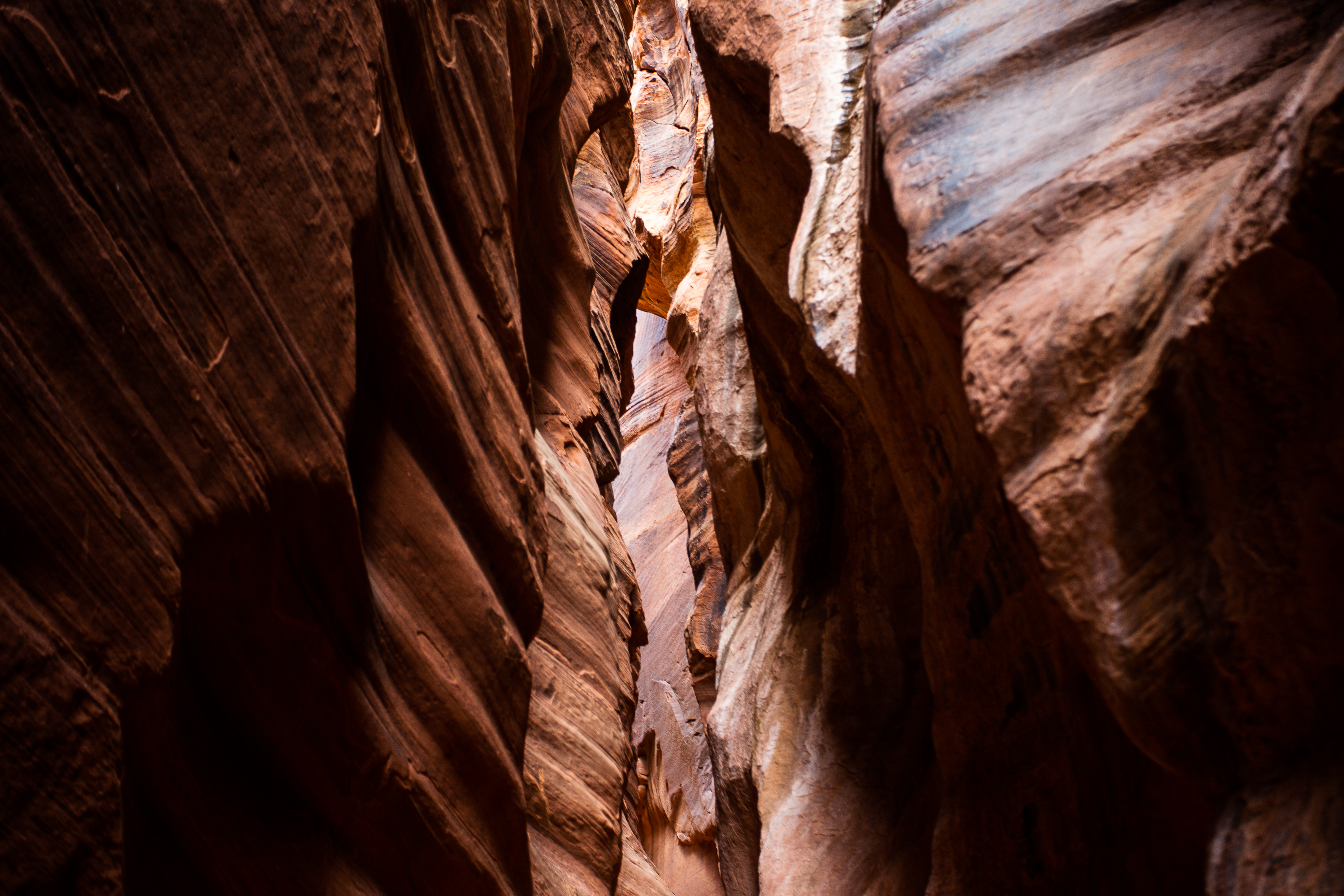
🎰 Hit The Slots
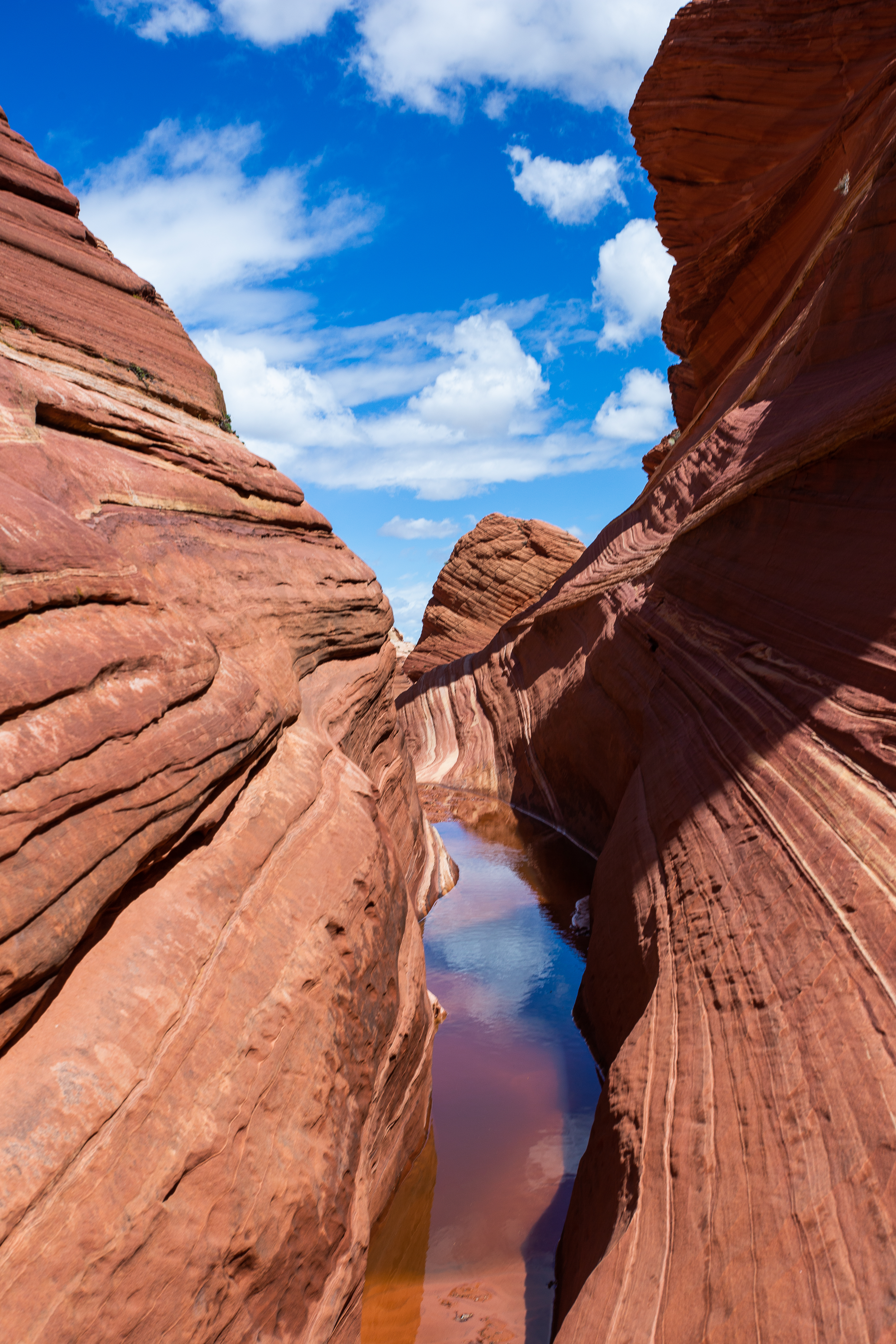
Leaving Coyote Buttes, we decided to walk a bit down Wire Pass towards Buckskin Gulch.
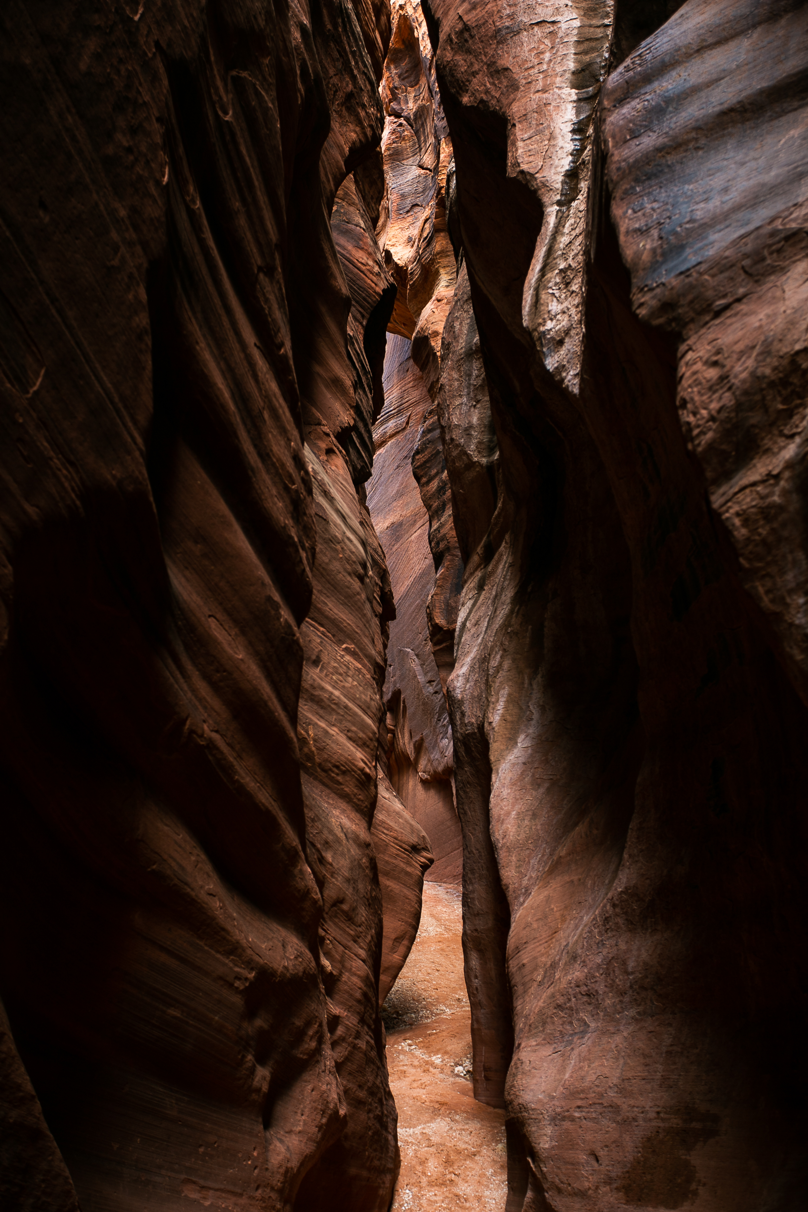
Both Wire and Buckskin are slot canyons - canyons carved out by water that can be dozens of feet deep but barely wide enough to stretch your arms out at times. I wouldn’t call slot canyons dangerous, but they require more caution than usual. Usually found in flat, arid areas, the slightest rainstorm can turn them into death traps. Rainwater falling on dry, infertile ground can and will flow into these canyons, creating unusually strong flash floods. The area around a slot can be fairly dry while the canyon itself gets flooded by a storm that happened miles away.
Southern Utah has the world’s largest concentration of slot canyons, and at ~15 miles Buckskin Gulch is the longest of them - possibly the longest in the world.
🐴 Around the Bend
Departing from Coyote Buttes, we stopped in Page, AZ for some food. If you’re in this part of the country and looking for civilization, Page is the only game in town. Or…the only town in the game.
Page wasn’t even a designated place in the country until 1975, and the government once declared it to be the ‘most remote place in the country’. I don’t know if I’d go that far, but it is almost 300 miles from the closest major airport (Las Vegas).
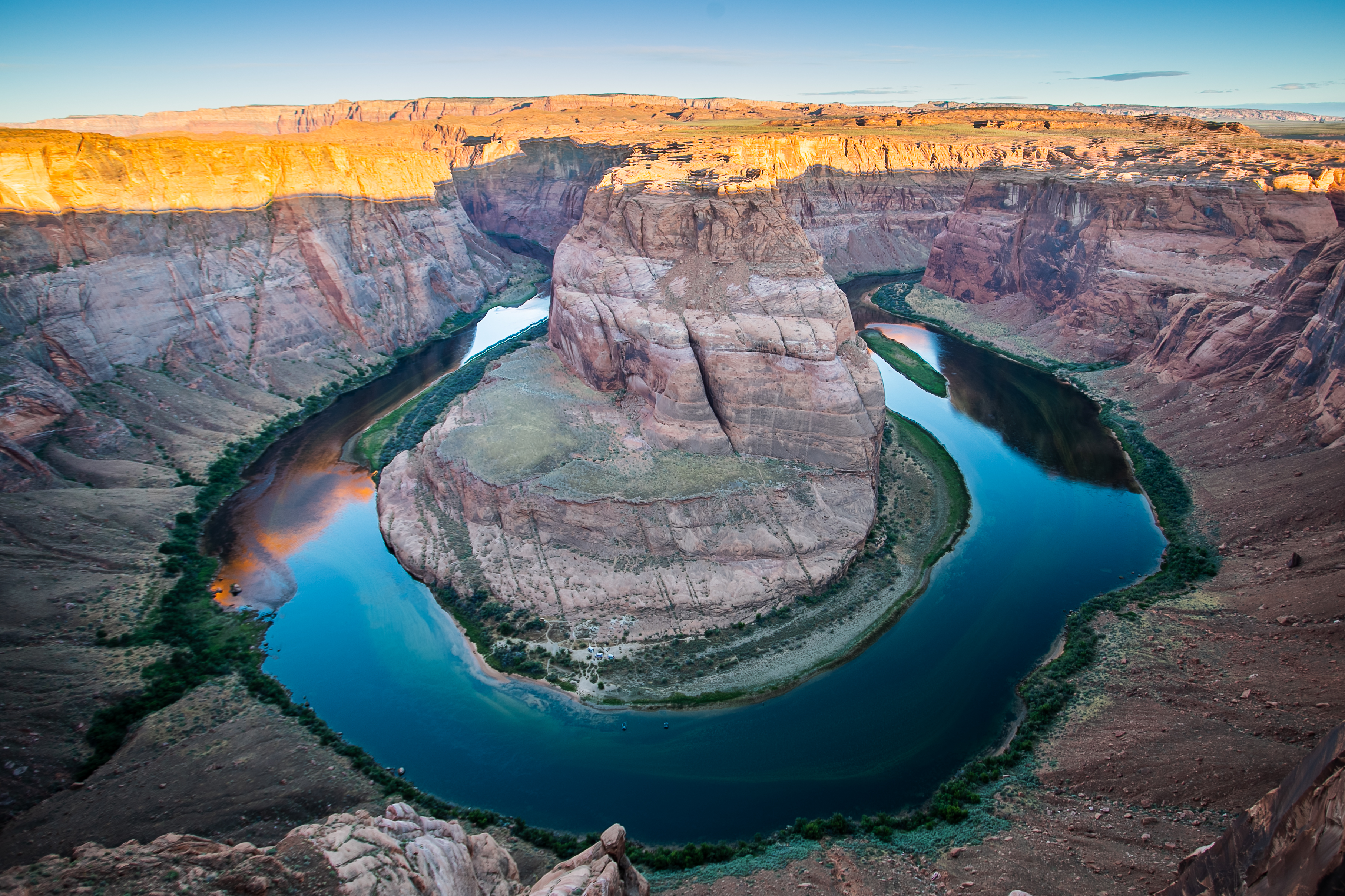
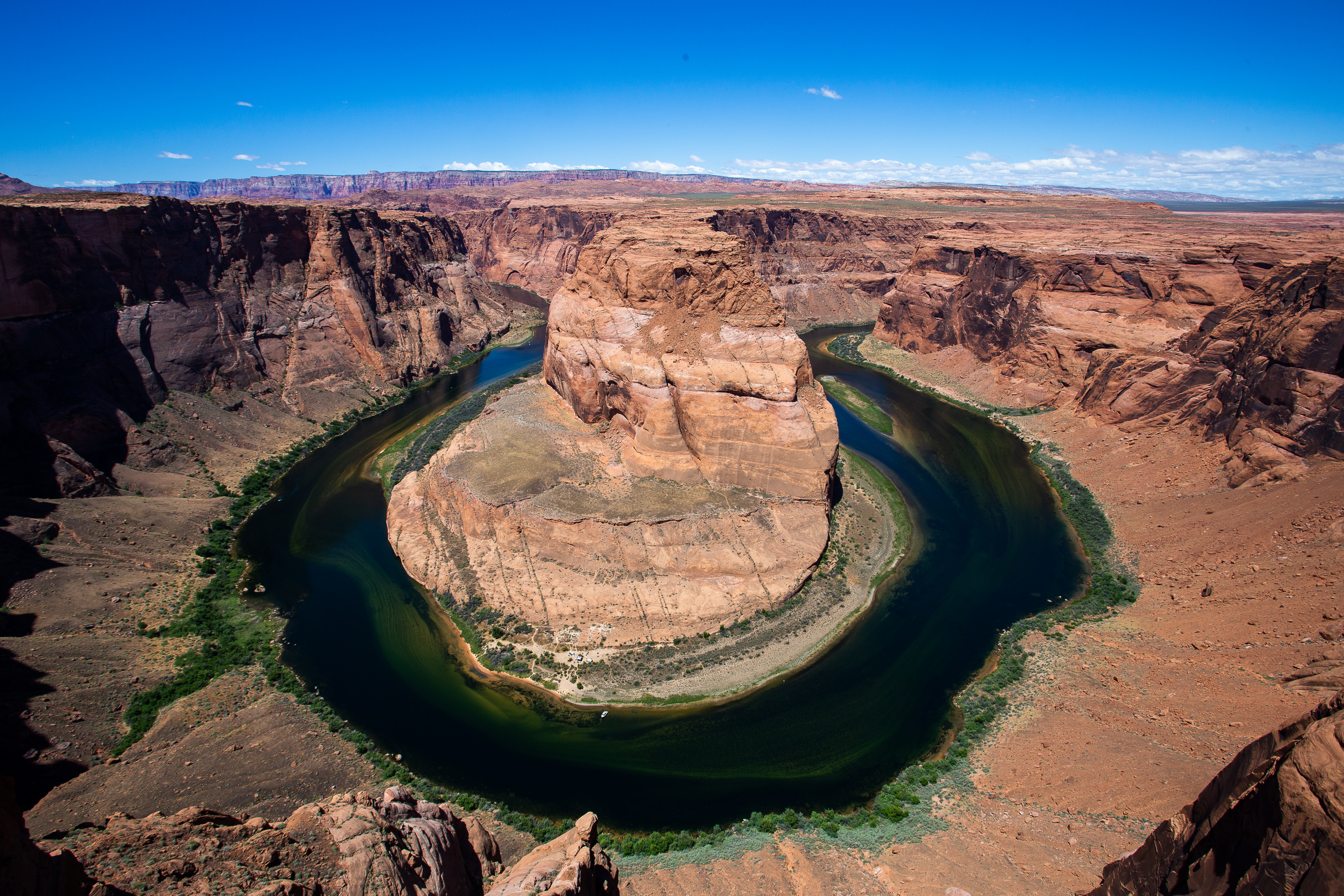
The town is quite literally next to Horseshoe Bend, another incredibly Instagrammable place (you can tell by how many other tourists will be there). The large amount of signs at the trailhead give you some insight into how prepared most people are out here. Despite being in a desert environment with no shade in sight, there are multiple signs in multiple languages warning people to bring water and sturdy shoes. The trail is a bit over half a mile each way.
Horseshoe is an especially scenic bend in the Colorado River, which goes on to form the Grand Canyon a few dozen miles south of Page. It does live up to its hype. If you can get past the armies of tripods and people aggressively looking for a photo angle that doesn’t include other tourists, you’ll have a fantastic time taking it all in.
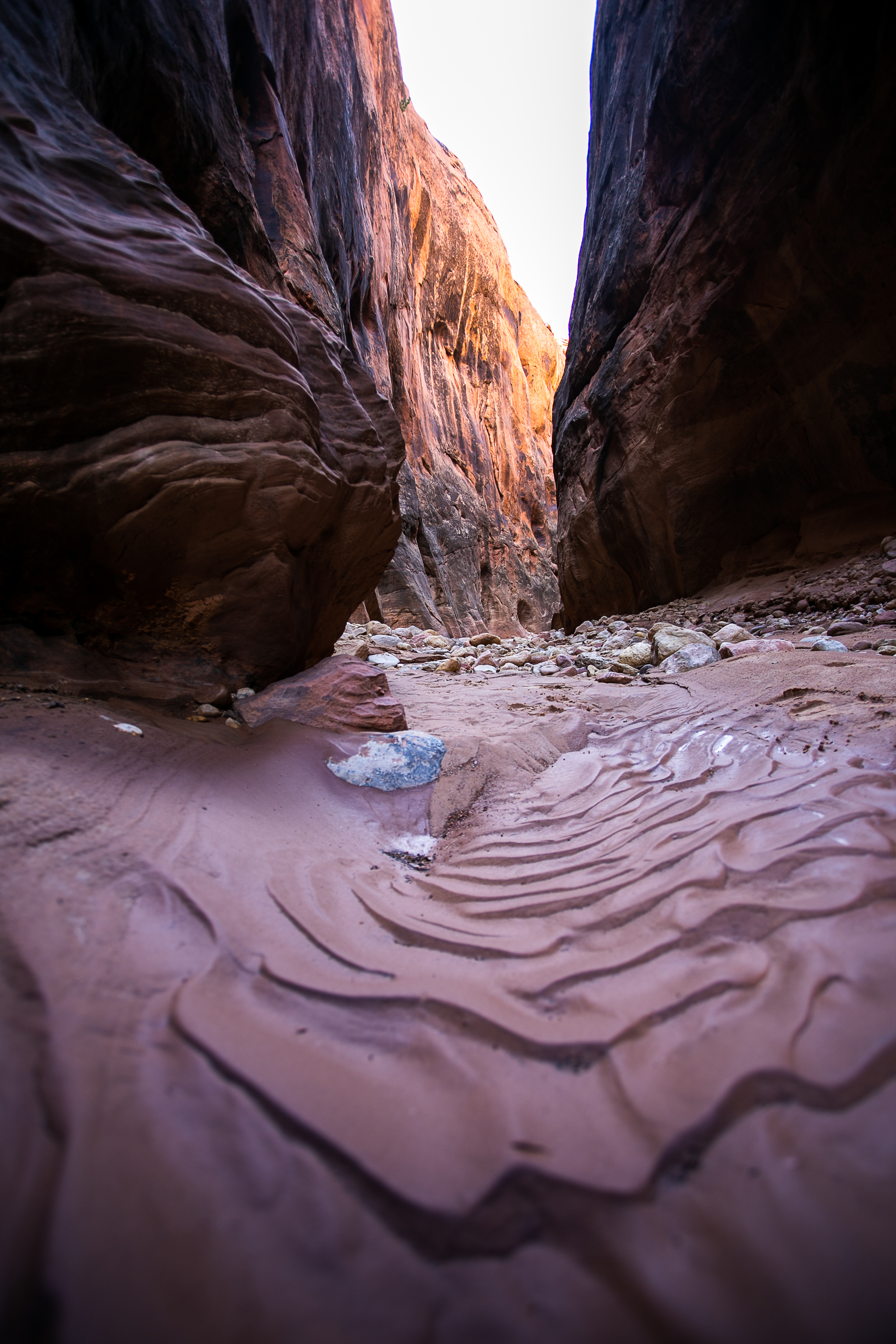
🕳 Waterholes - an alternative option
Once again, we spent the night sleeping in the car, this time in the Horseshoe Bend parking lot.
Heading back into Page for breakfast, we double checked the directions to our next destination: Waterholes Canyon.
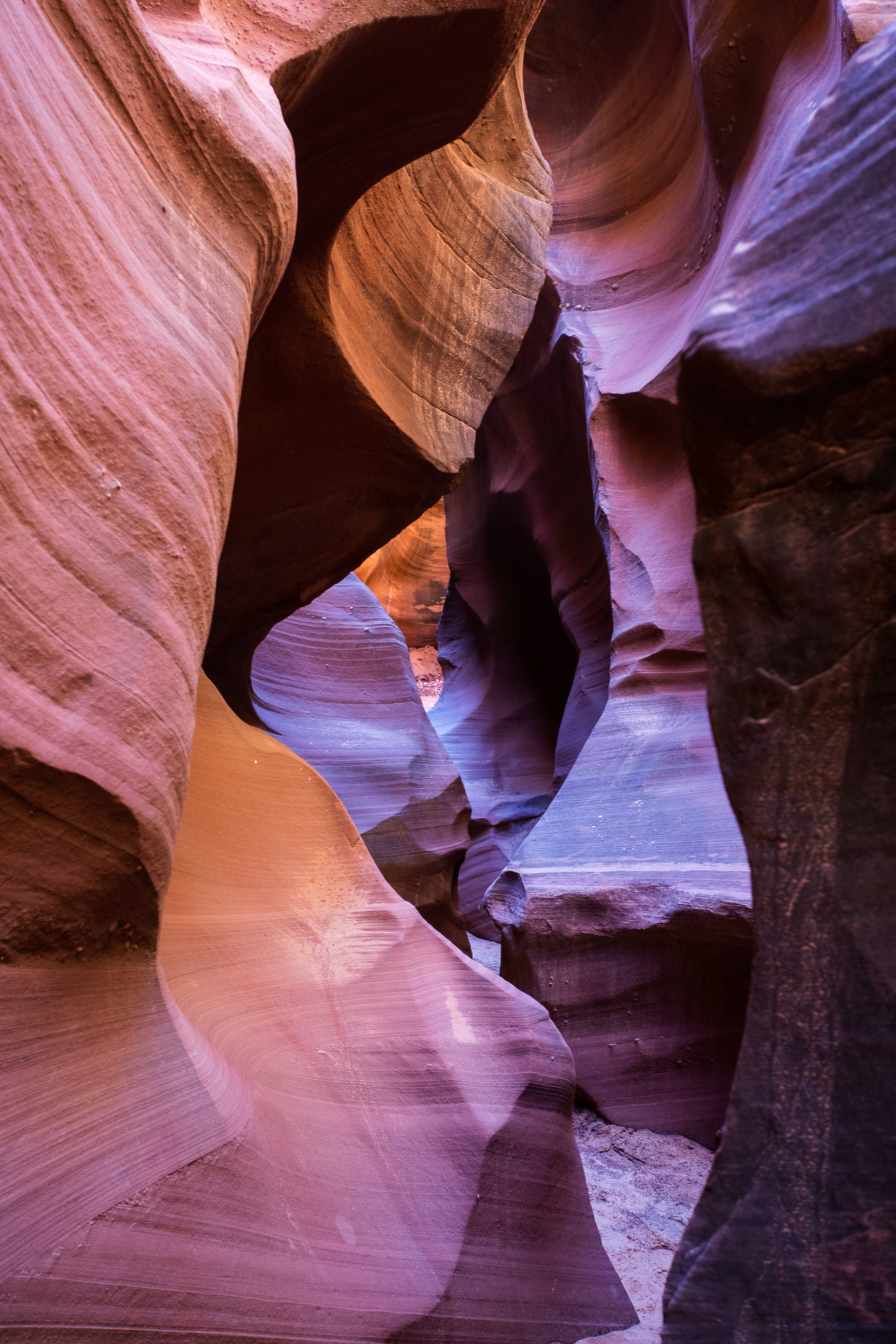
We definitely wanted to spend a full afternoon hiking through a slot canyon, as opposed to our brief trip into Buckskin Gulch. The obvious answer is Antelope Canyon. Antelope is ridiculously photogenic, and it was introduced to a massive amount of people when a photo of it was included as one of the default wallpapers for MacOS X back in 2012.
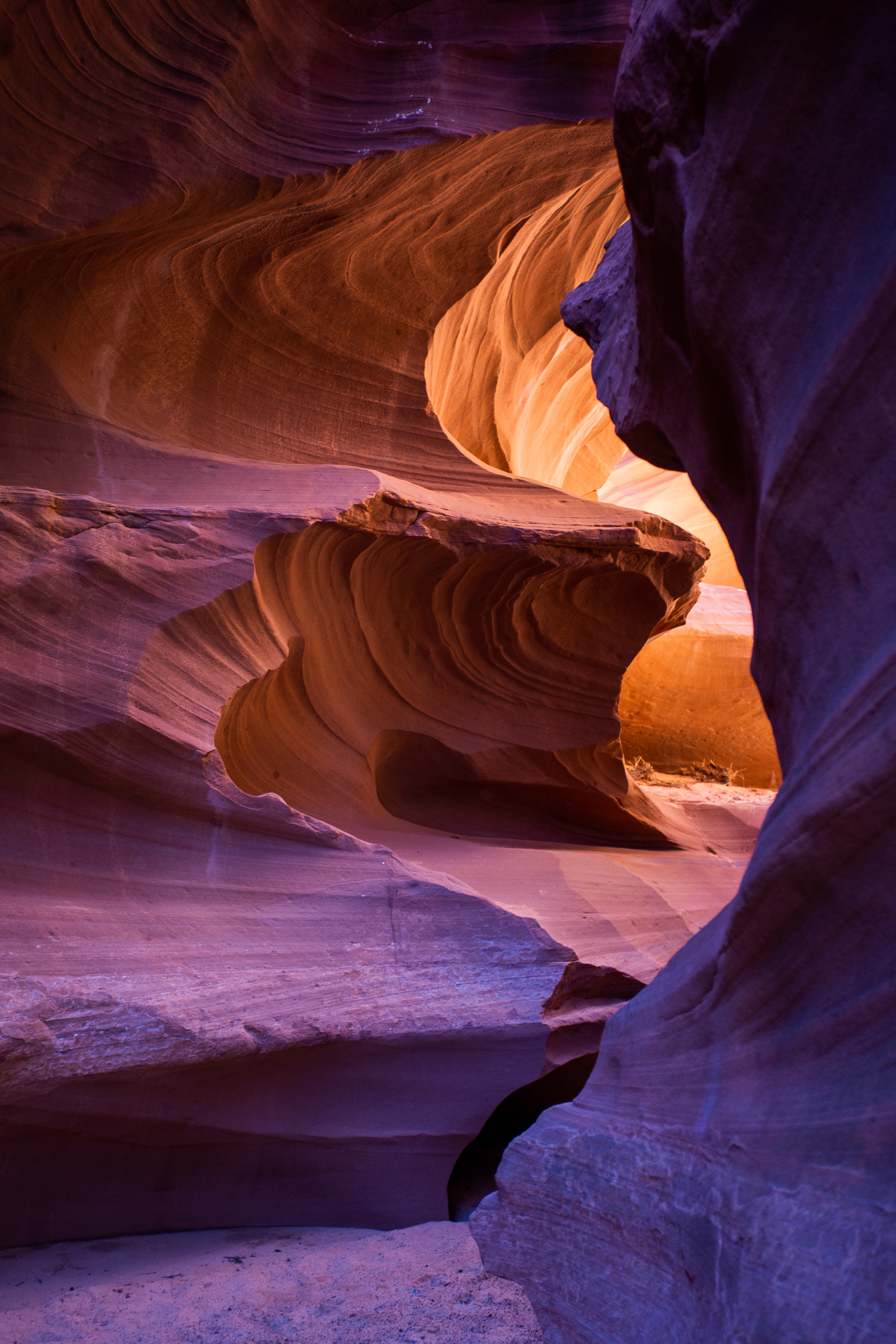
Antelope can only be accessed by going on a guided group tour, and those had a reputation for being crowded. So Stef found an alternative - Waterholes Canyon.
Both canyons are on Navajo land and managed by the tribe. At the time, the only requirement for visiting Waterholes was to fill out a form and mail it to the tribe for a permit. As of a few years ago, Waterholes is inaccessible except by guided tour.
I haven’t been to Antelope, but I will say that we only saw two people in Waterholes and there was plenty of natural beauty to go around.
Once we finished up at Waterholes, we drove to our final stop for the trip: the Grand Canyon.
🥾 Rim to Rim
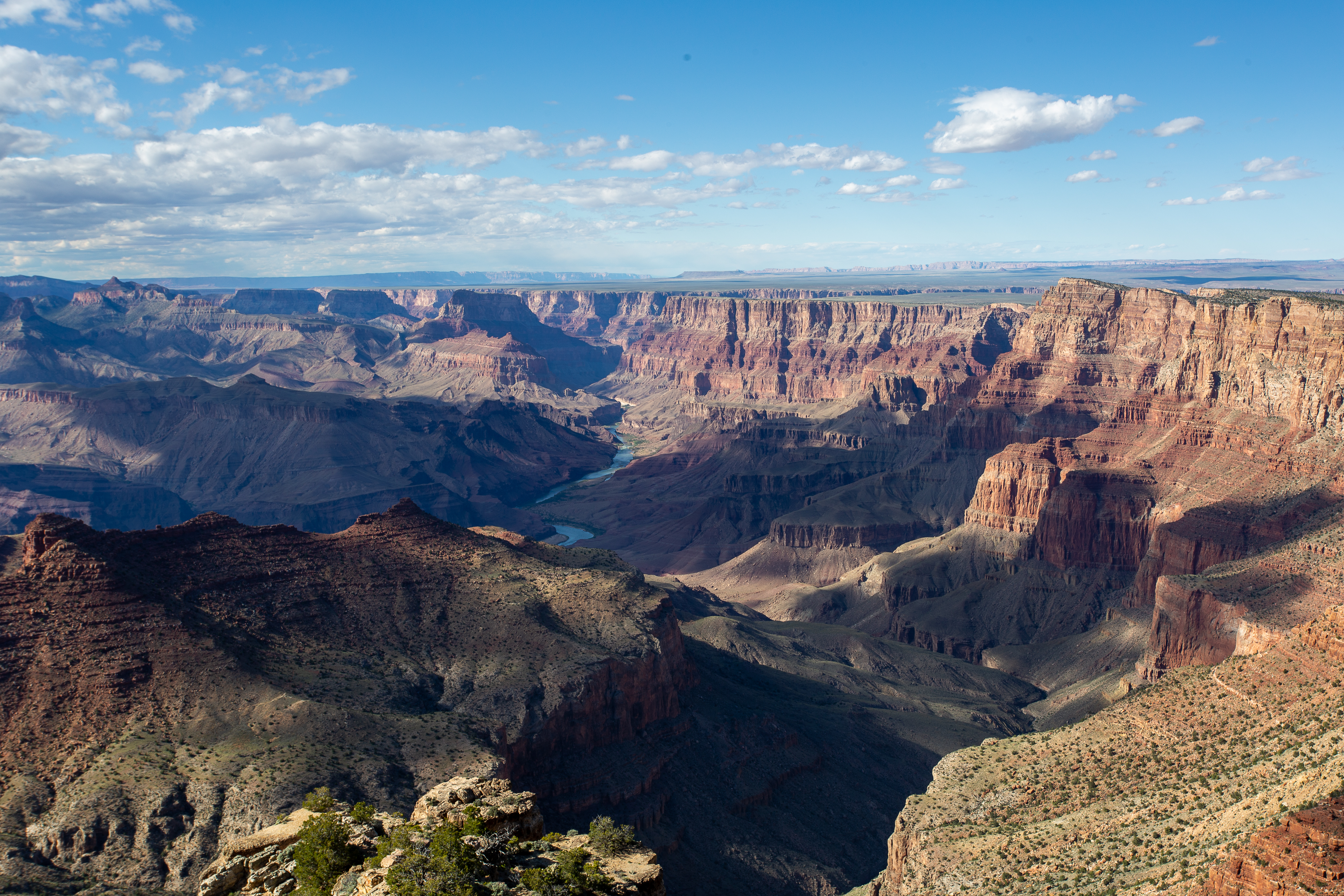
Due to the timing of our trip, we could either fly out of Vegas on Friday, or find something to do in the area for the weekend. We decided to stick around and do a rim-to-rim hike at the Grand Canyon.
This is an easy hike to plan, but a difficult one to execute. There are three main trails leading to the bottom of the Canyon: two leaving from the south rim, and one from the north. By car, the north rim is 5 hours away from the more populated south rim, so we didn’t consider it.
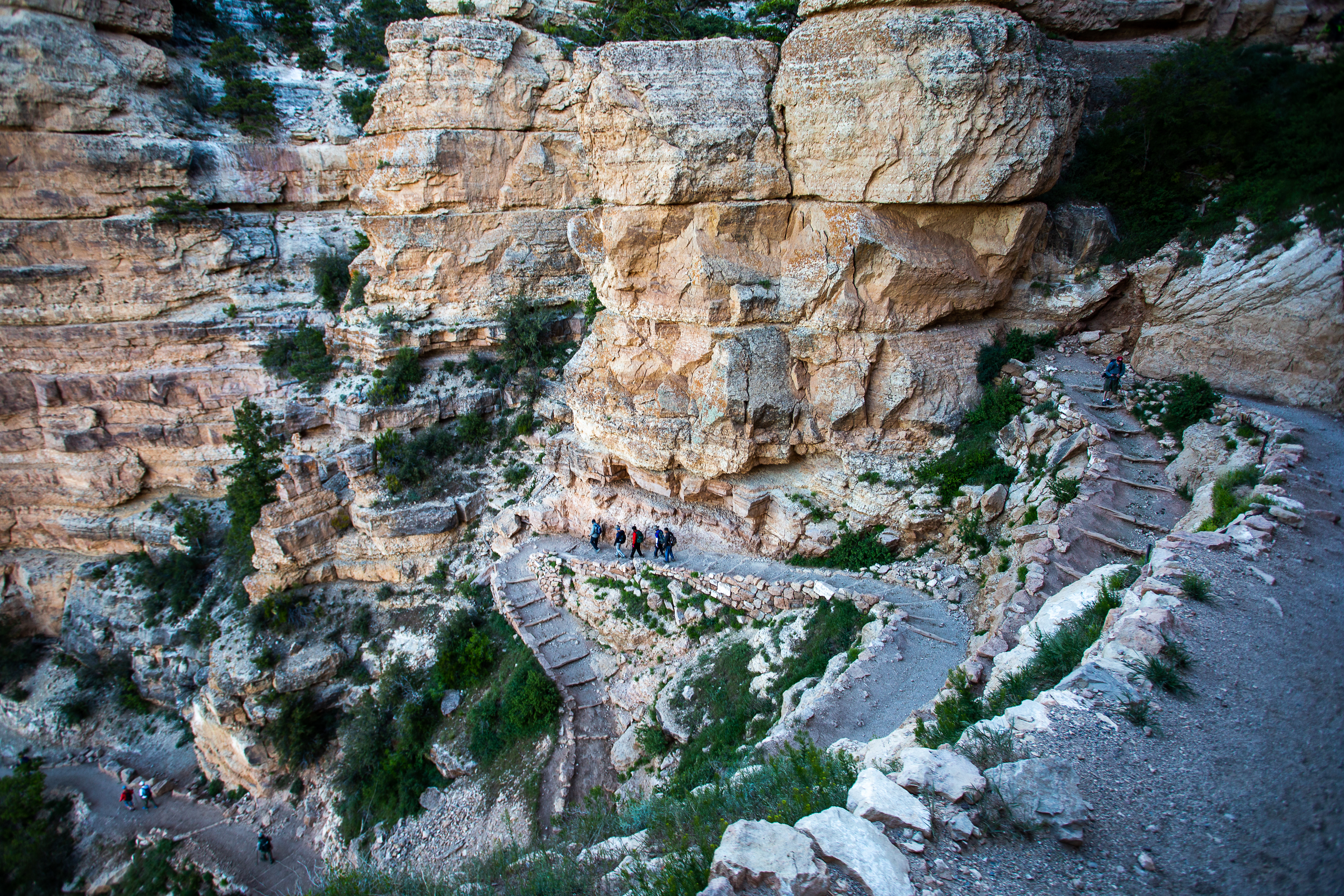
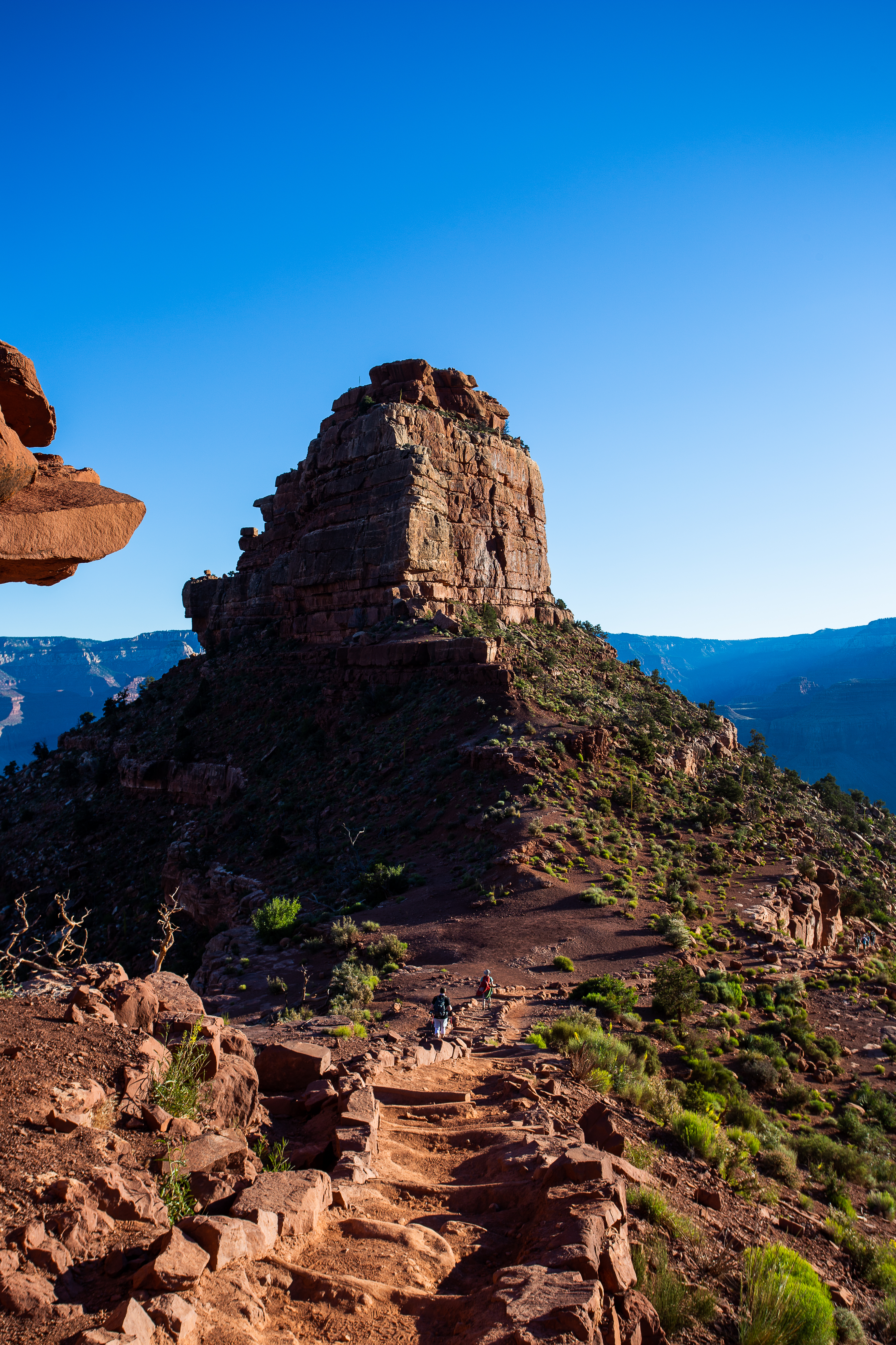
Of the two southern trails, the South Kaibab trail is the steeper one and has no water sources. The Bright Angel trail is slightly less steep and has water spigots every ~1.5 miles. It makes the most sense to hike the South Kaibab down and Bright Angel back out, since you’ll need much more water and energy going uphill.
To make it even easier, you can park at the visitor center by the Bright Angel trailhead, then take a free shuttle to the South Kaibab one. The shuttle schedule is different each month, but when we were there we caught the earliest one at 5am.
If you ever tackle this hike, you will need as much time as you can get. With around 5,500ft of elevation gain, very little shade, and potentially unpredictable weather, this hike will push you to the limit. But for what it lacks in ease it makes up for in simplicity - you start at the top of a canyon, walk down, and walk back up and out.
Comments