Utah Parks In The Winter: A Photo Essay
Scroll DownOff-Season Travel
Utah has five National Parks, nicknamed The Mighty 5 by the state. This winter I took a trip to the three on the western side of the state.
Going in the winter was a very intentional choice on my part. All of the Utah parks are extraordinarily popular (with the exception of Capitol Reef), and visiting them in the spring, summer, or fall is more like going to Disneyland than going into nature for solitude.
Zion National Park is the most extreme example here - for 9 months every year you can’t even drive into the park itself. It can only be accessed by shuttle buses, and on holiday weekends you could be looking up to an hour and a half to enter the park, and up to 4 hours to start hiking one of the popular trailheads.
However, if you visit in the wintertime, you can avoid all of this. The parks are relatively empty, lodging is cheap, and there’s a chance you’ll even get good weather. Here’s a brief rundown of the three parks I visited.
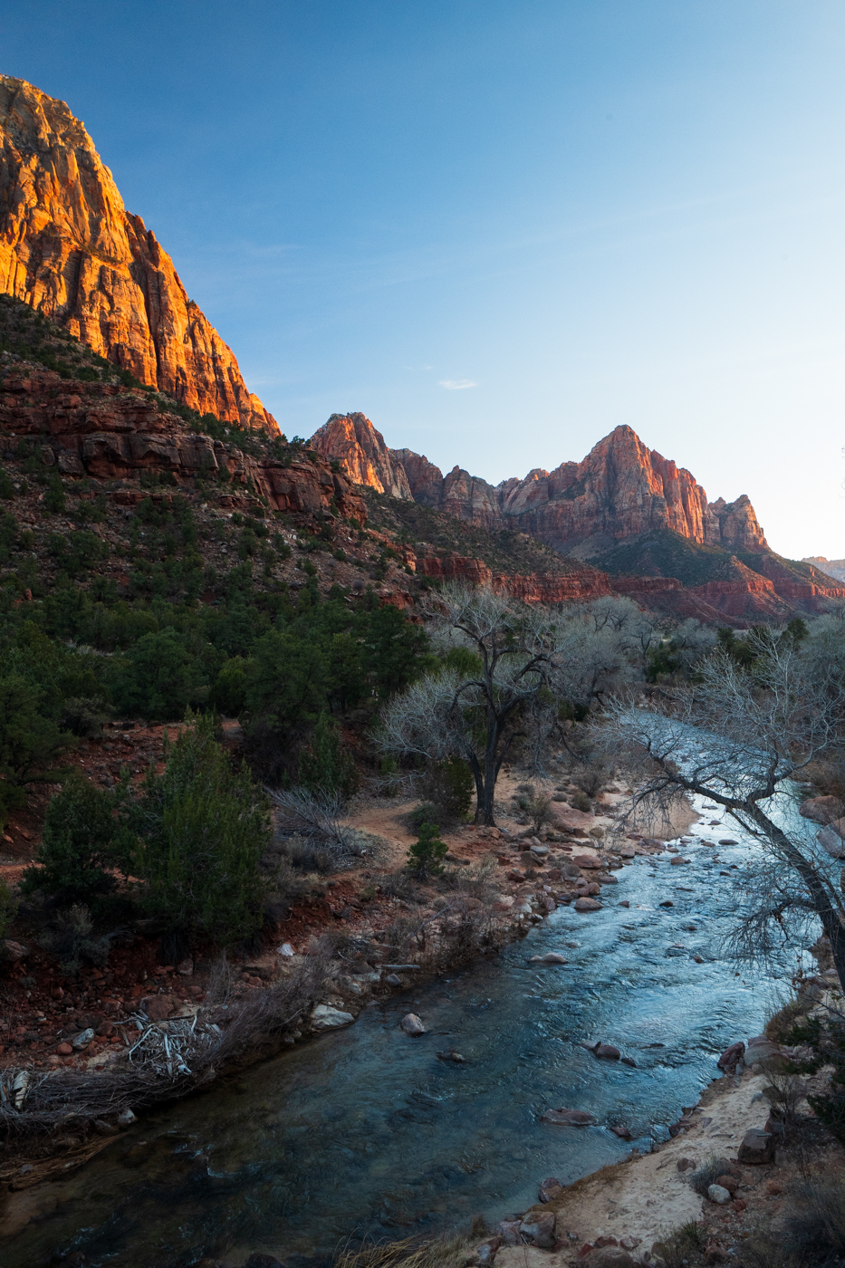
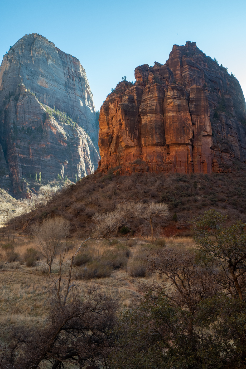
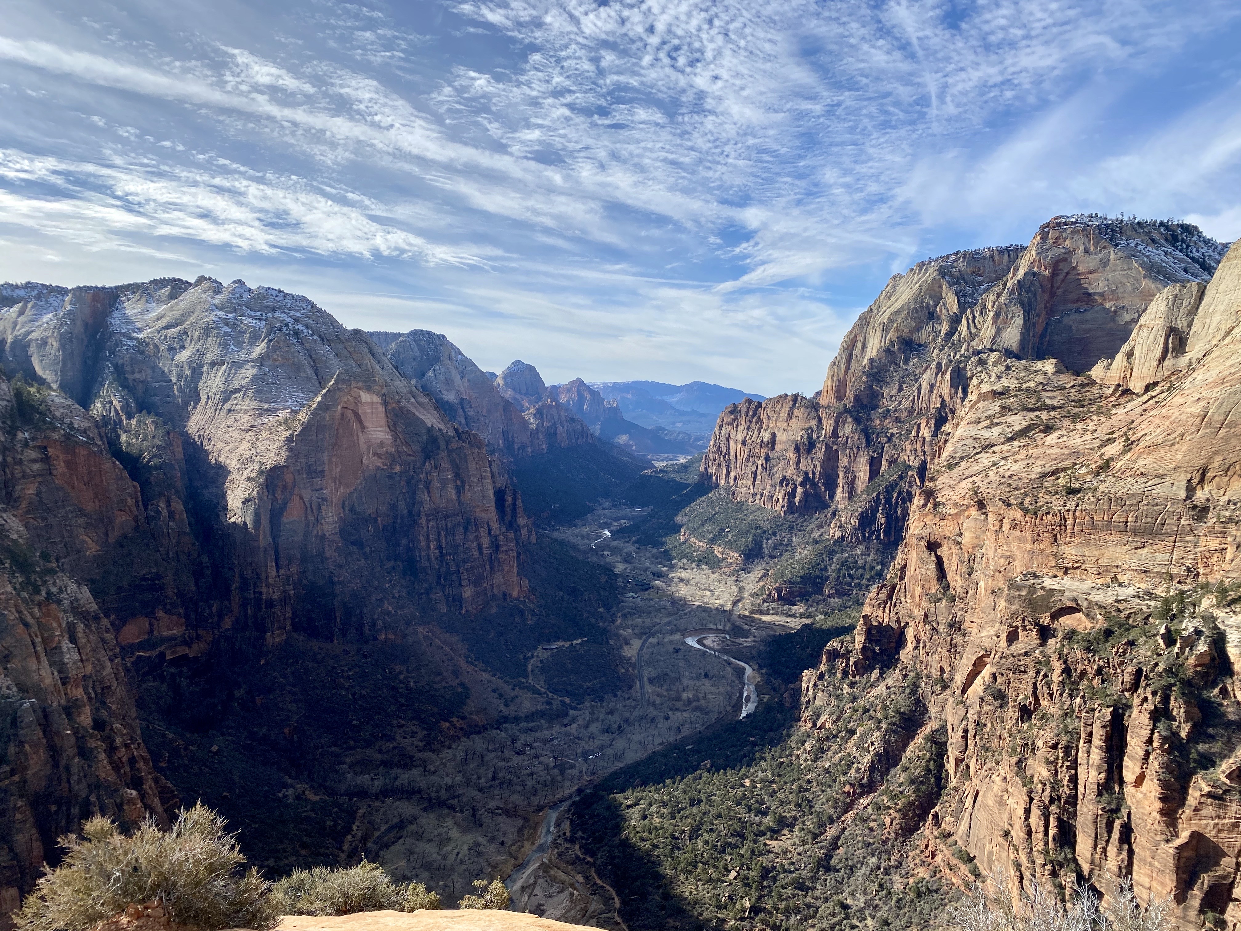
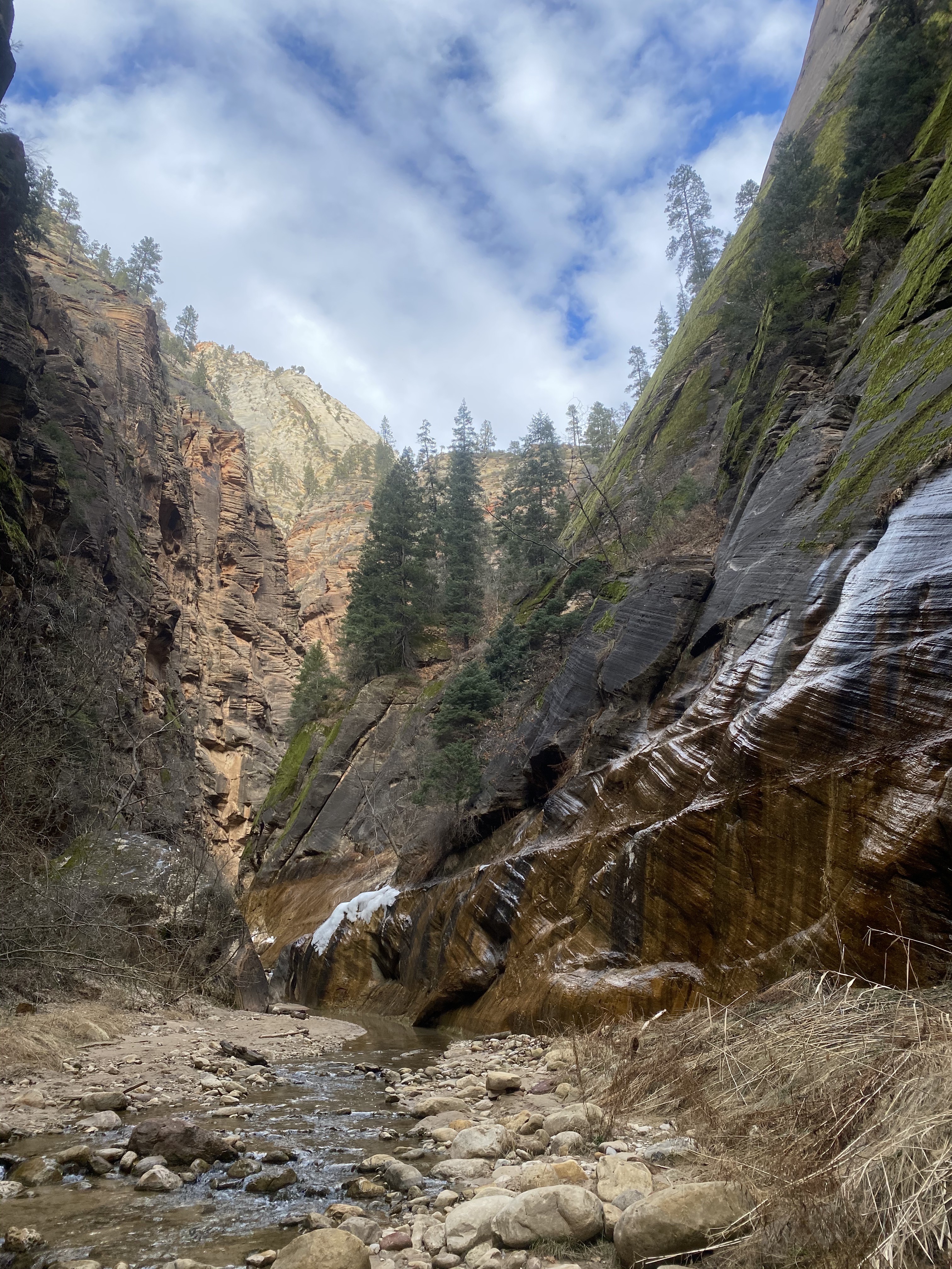
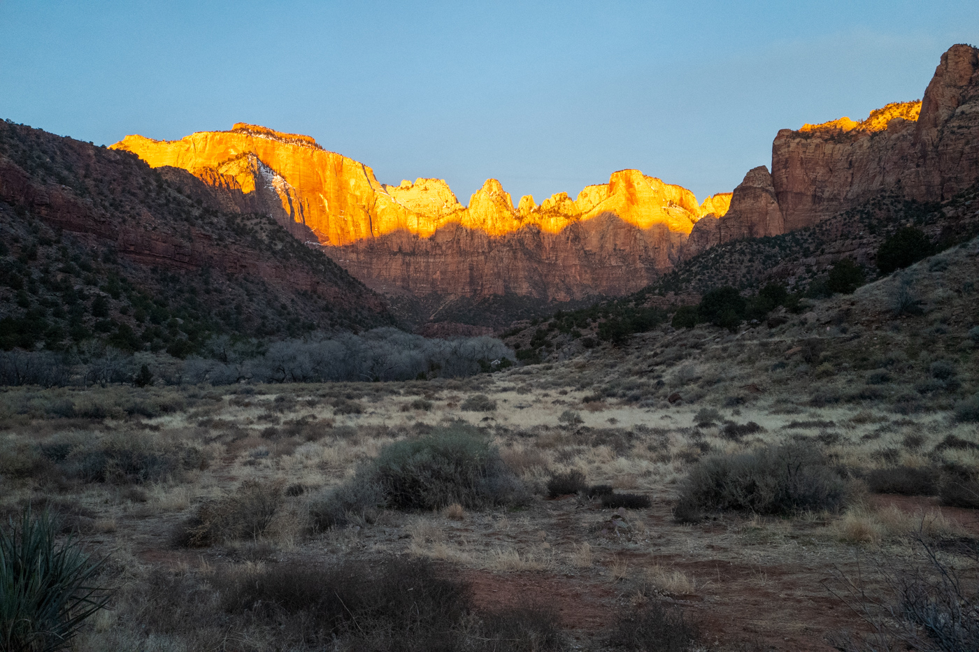
Zion
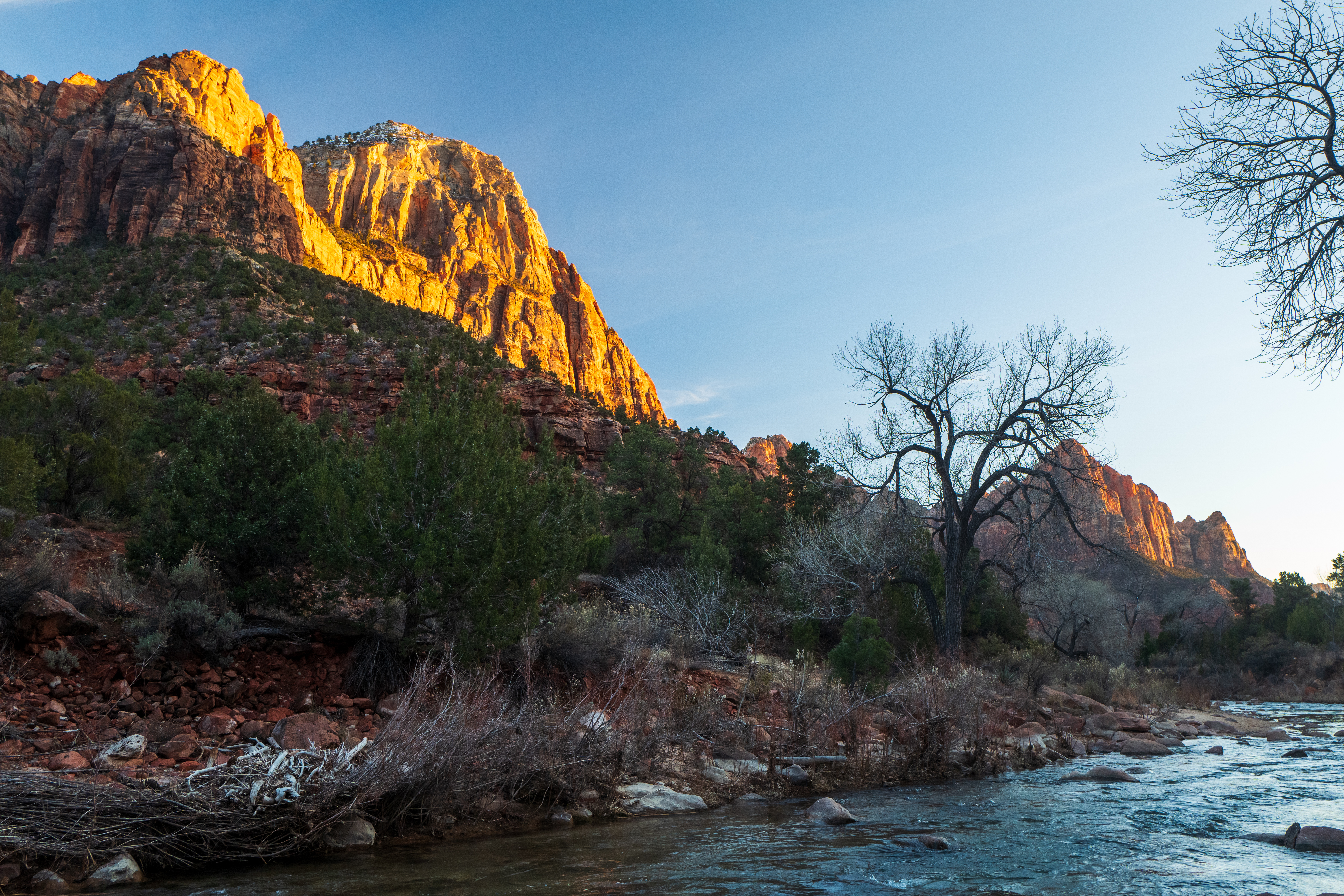
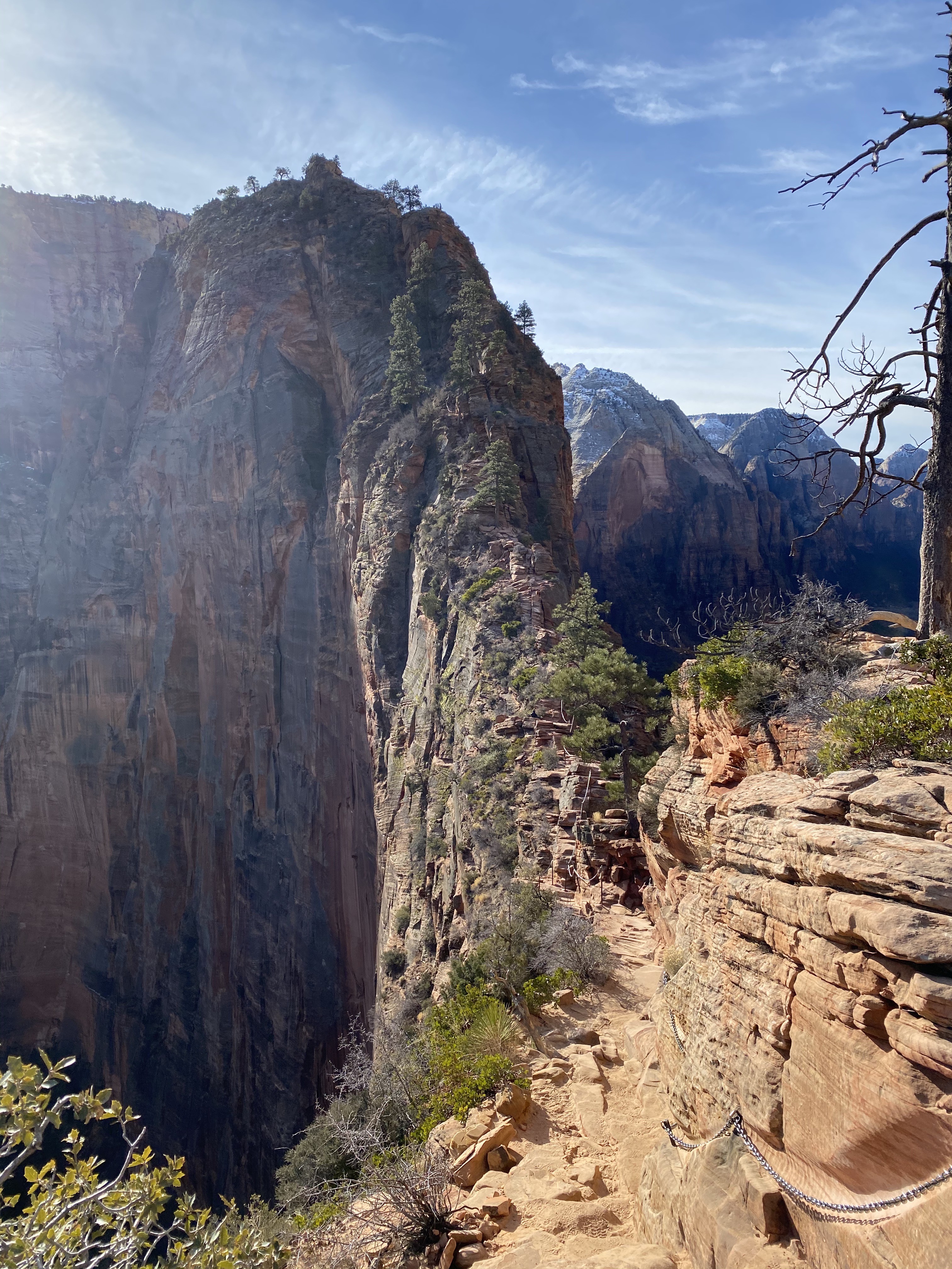
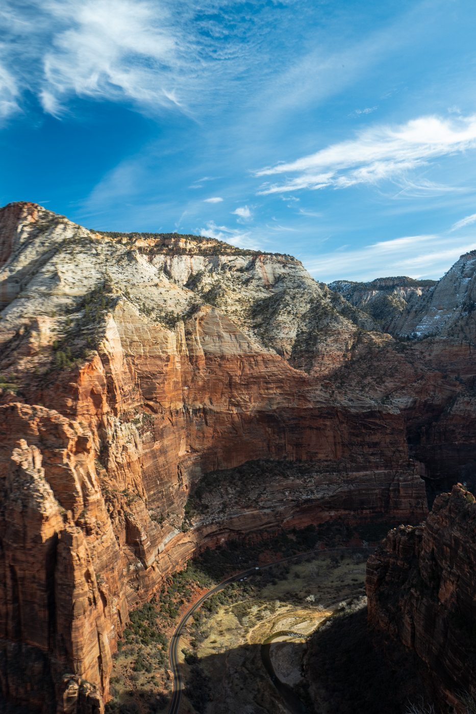
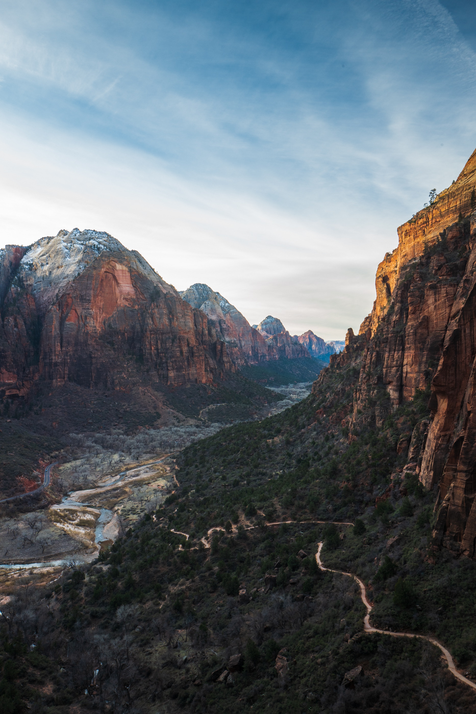
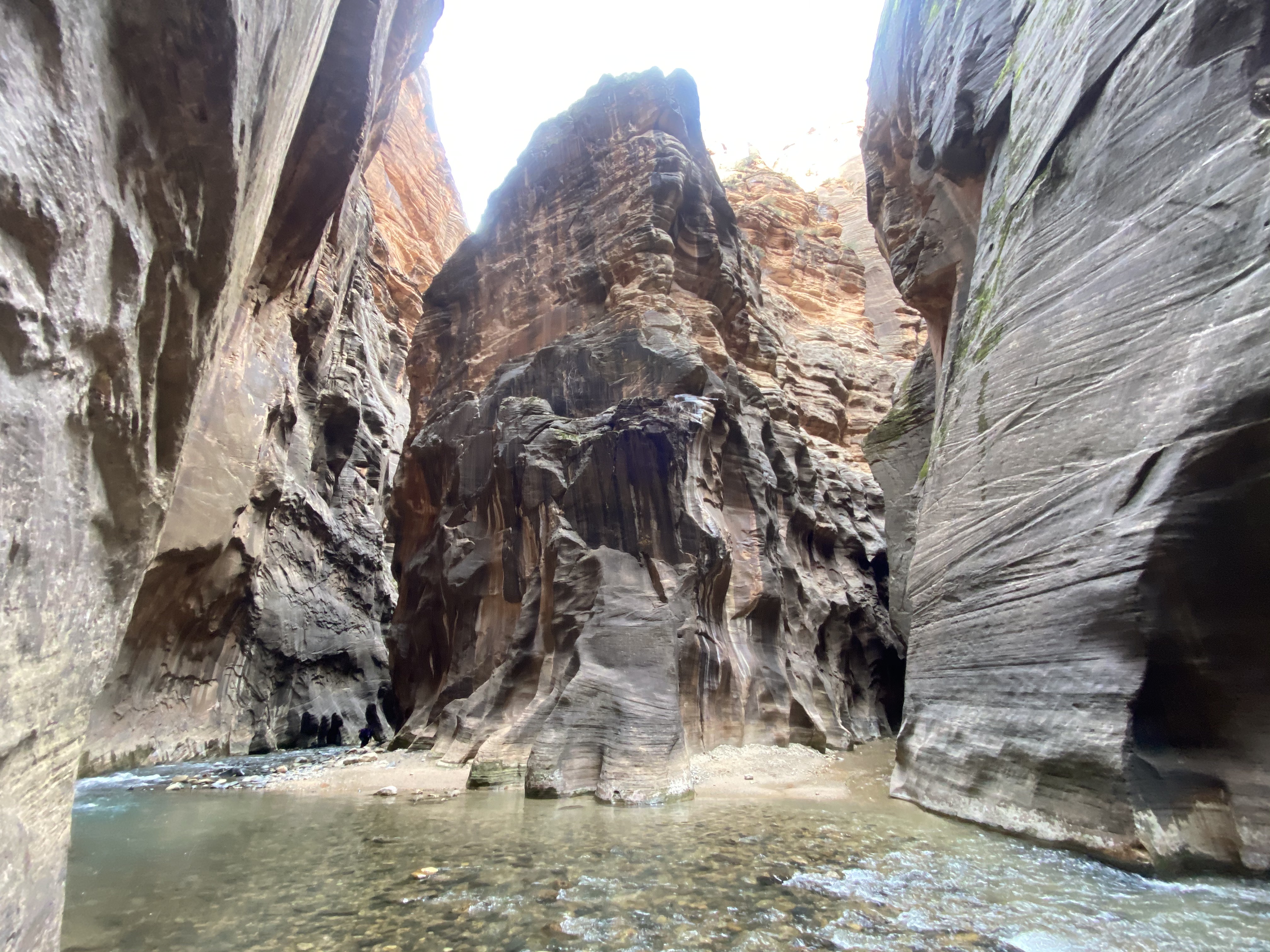
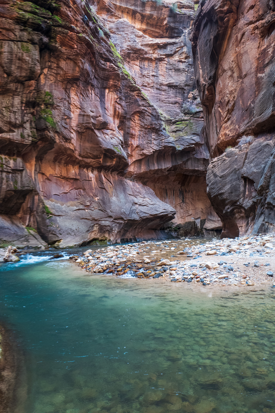
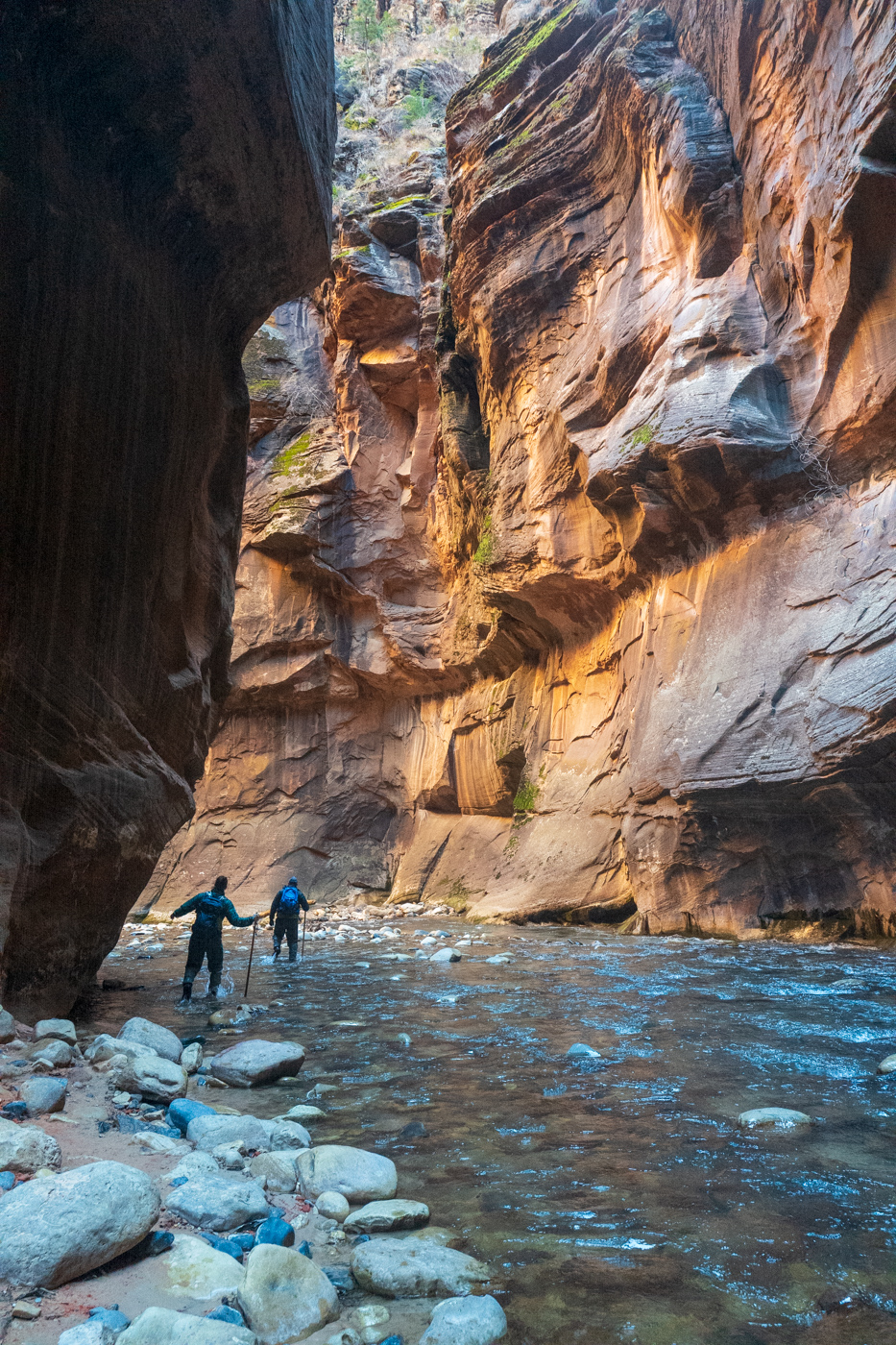
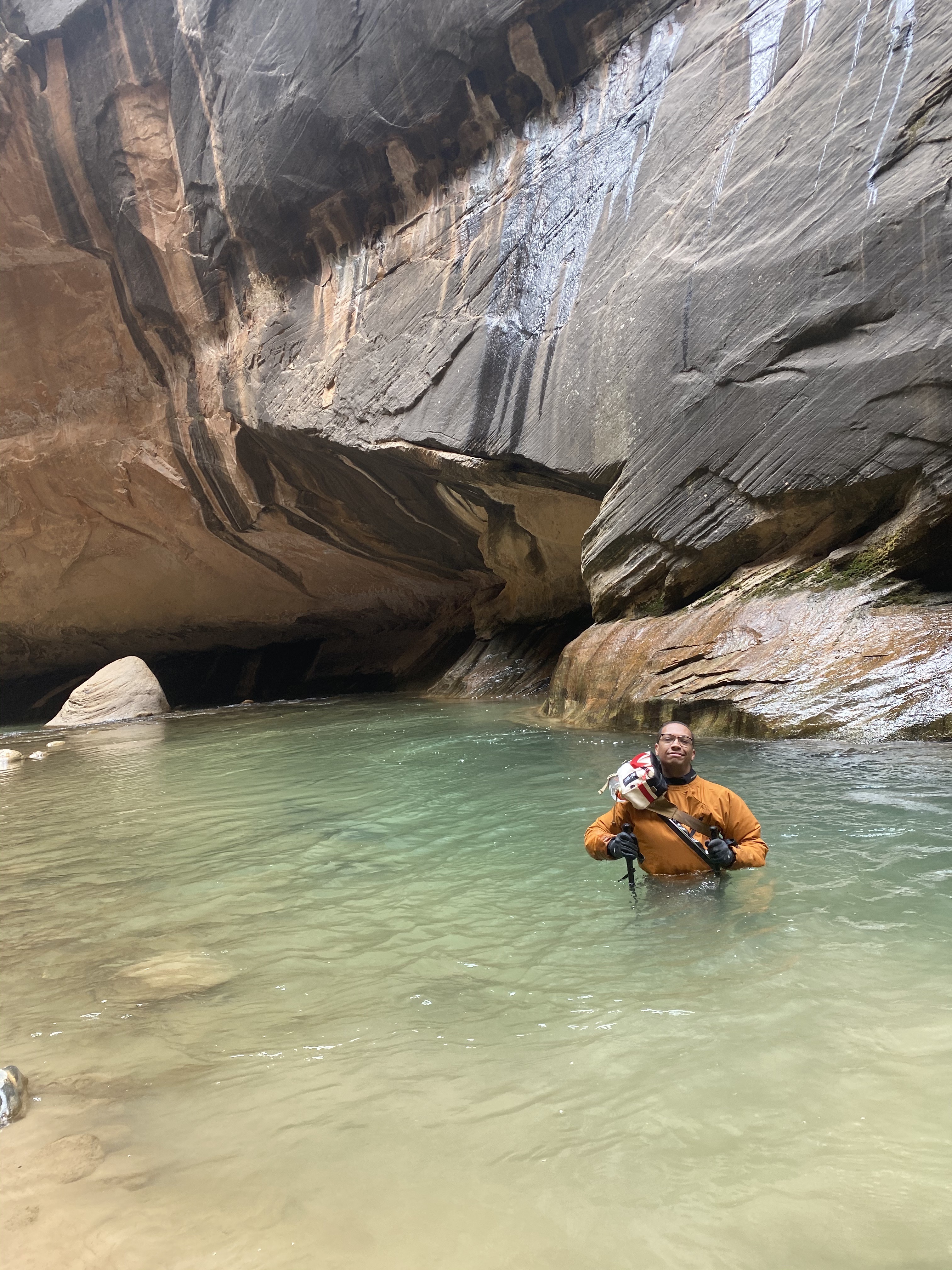
The main feature of Zion is Zion Canyon - a narrow, deep red-orange sandstone canyon. The Park also protects a massive swath of land around it that contains many more small slot canyons, mountains, and rivers. Overall, Zion is one of many parks where there isn’t a central focus, just an overwhelming sense of “Whoa!”.
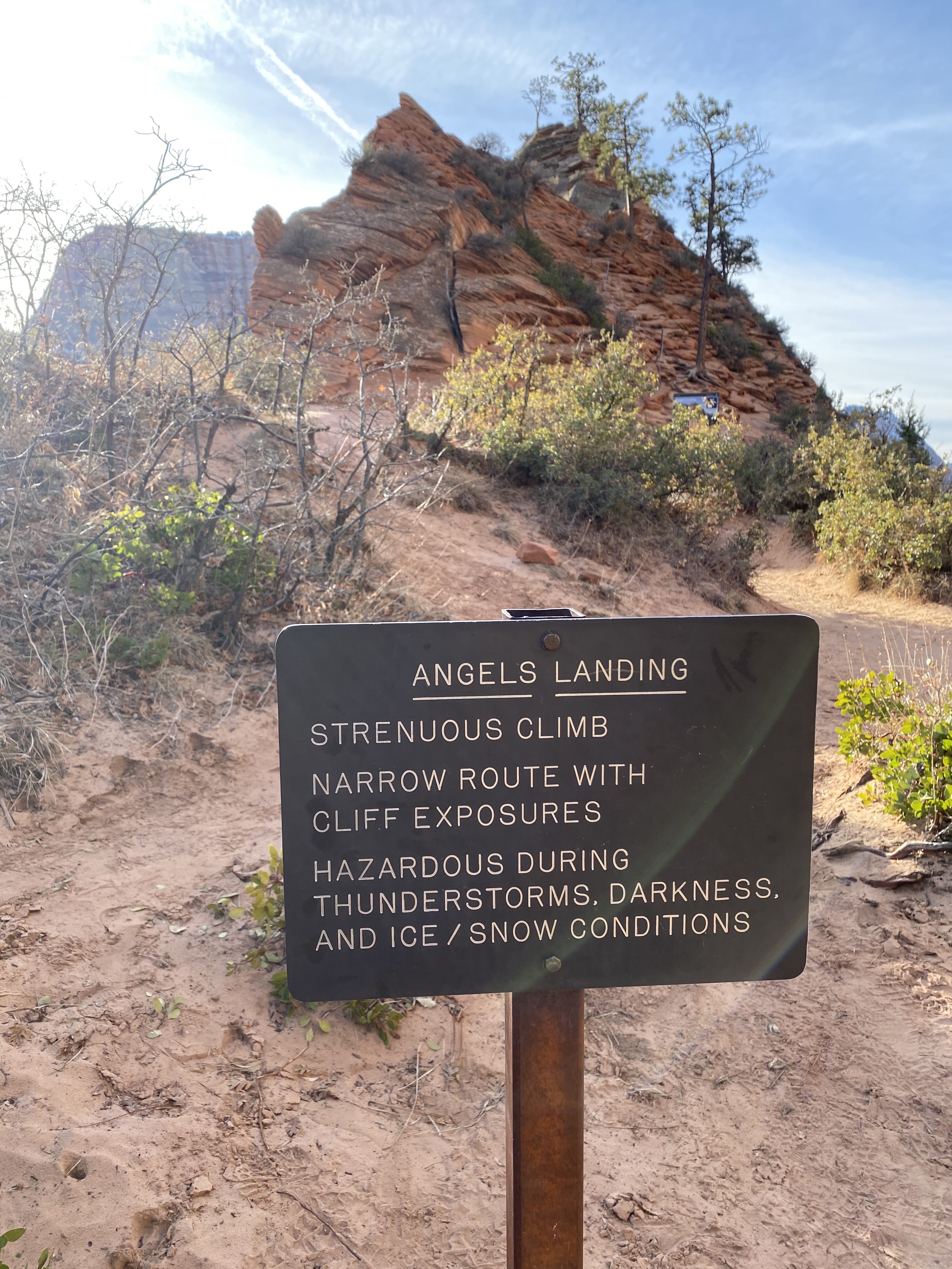
Being able to drive through the park in the winter offers a rare chance to do Zion’s two famous hikes in one day. Angels Landing is famous for steep dropoffs into the canyon, and The Narrows is an infamous canyon that requires you to hike through it in a drysuit when the water is too cold. Outside of winter, the long lines and wait times for the shuttles make this a logistical nightmare.
Many of the rock formations in Zion have extremely dramatic nicknames, hence the captions.
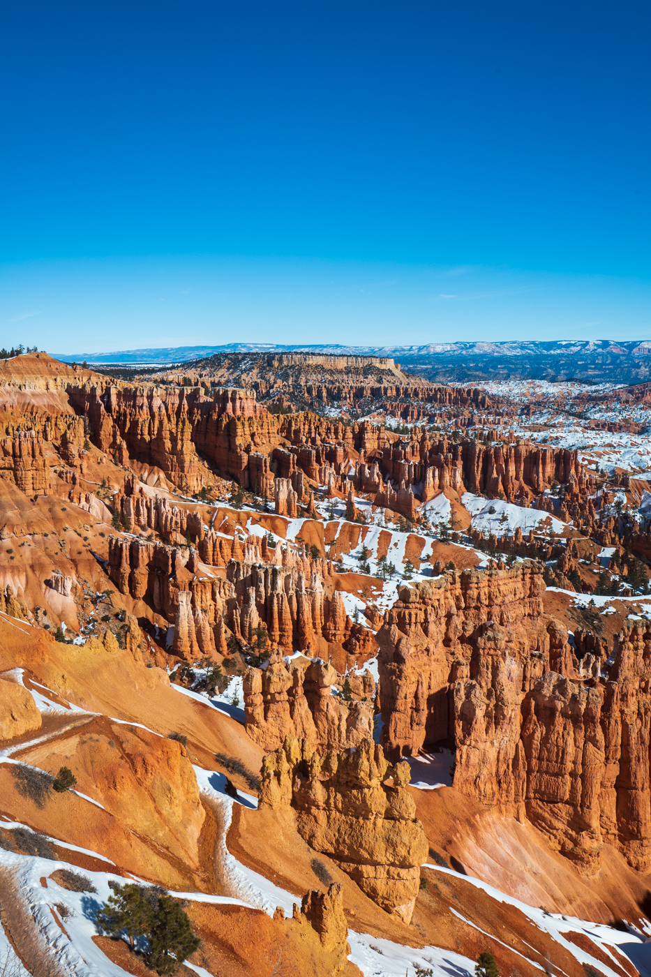
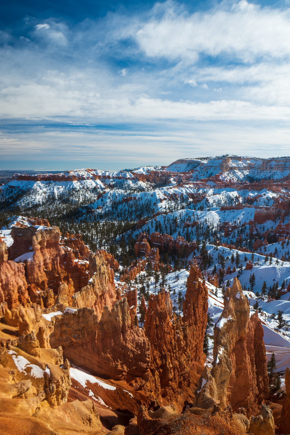
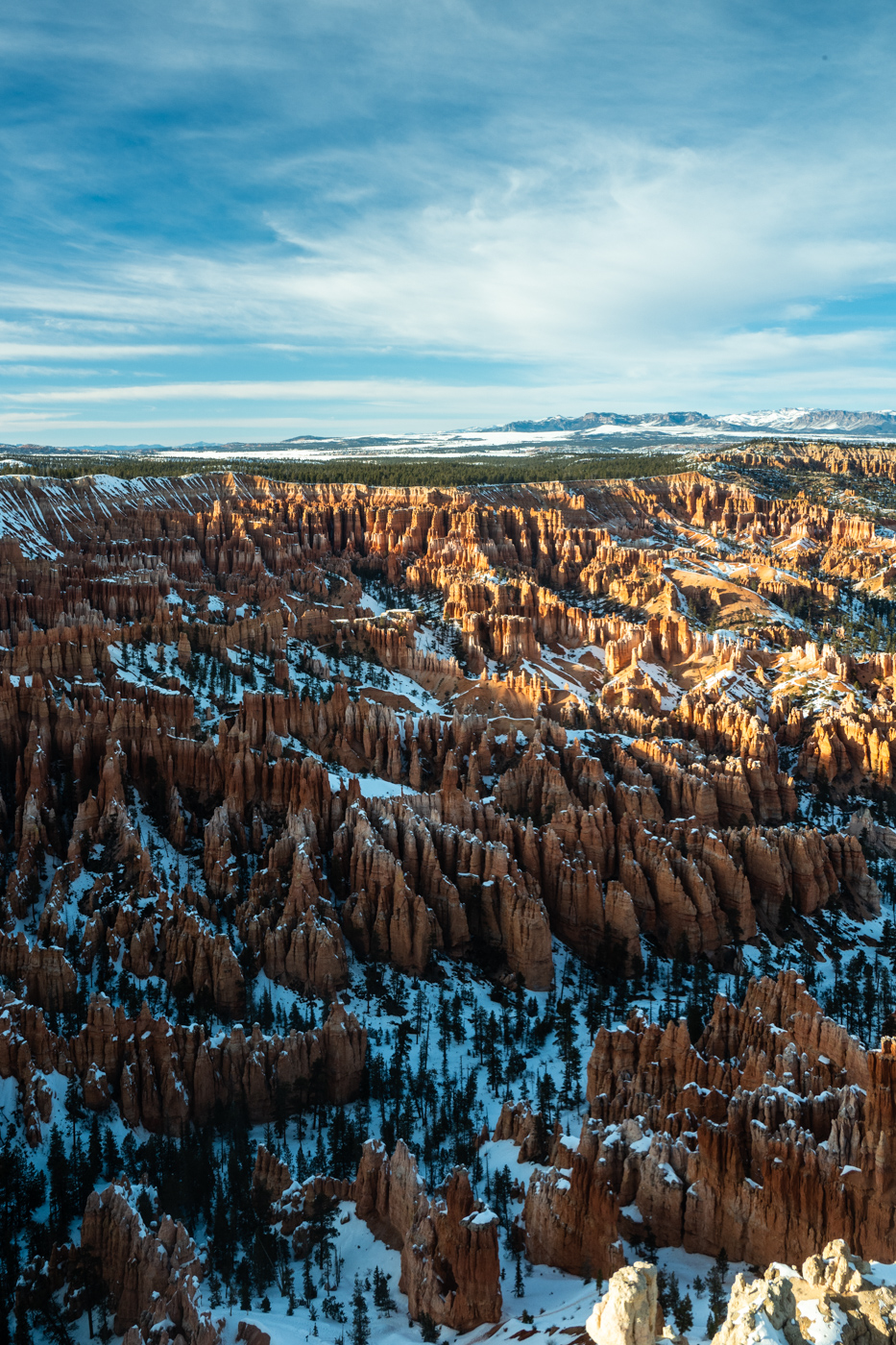
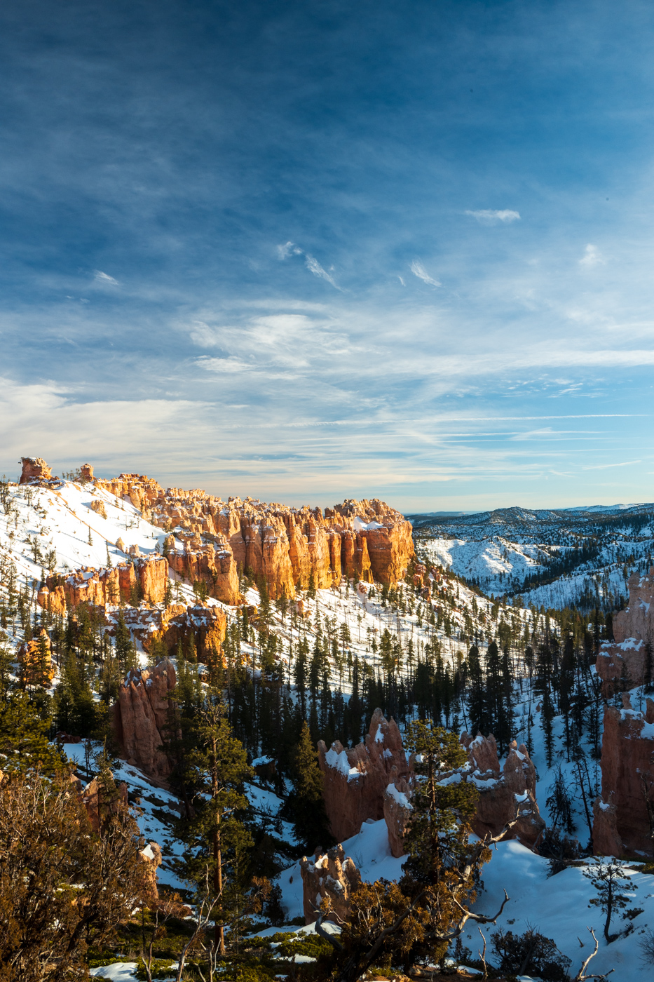
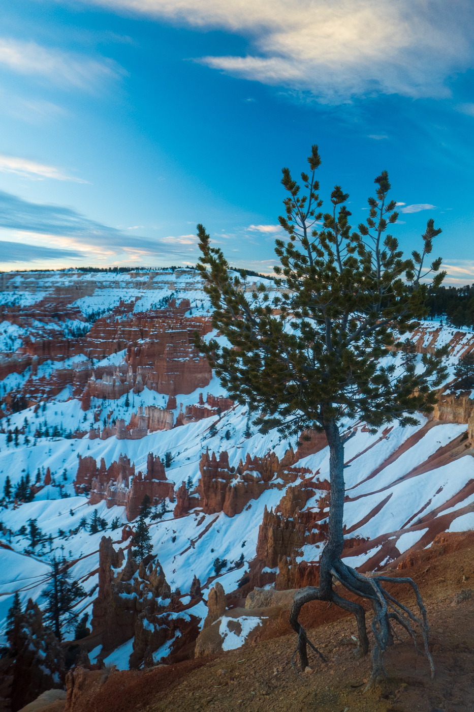
Bryce Canyon
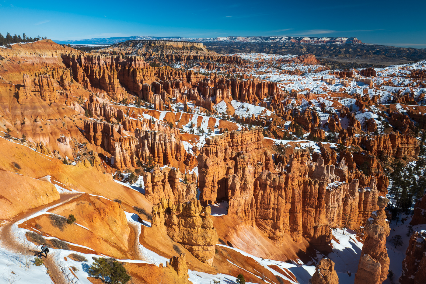
Bryce Canyon has the worlds largest collection of hoodoos. Essentially, you get hoodoos when there’s a soft layer of rock covered by a much denser, stronger layer. When cracks develop in the stronger layer, rain passes through and can erode away the weaker layer below it. Sometimes this can leave ‘pillars’ where everything around an area erodes away and a freestanding column of rock remains.
In Bryce, almost all of the erosion is due to frost wedging. Water seeps into cracks and expands once it freezes, quickly eroding away weaker rocks. The main section of this Park is the ‘Ampitheater’ - a small collection of canyons that are absolutely littered with hoodoos.
I don’t think it needs to be mentioned, but the sight of these bright orange hoodoos against crystal clear skies and white snow is a unique and truly one of a kind experience.

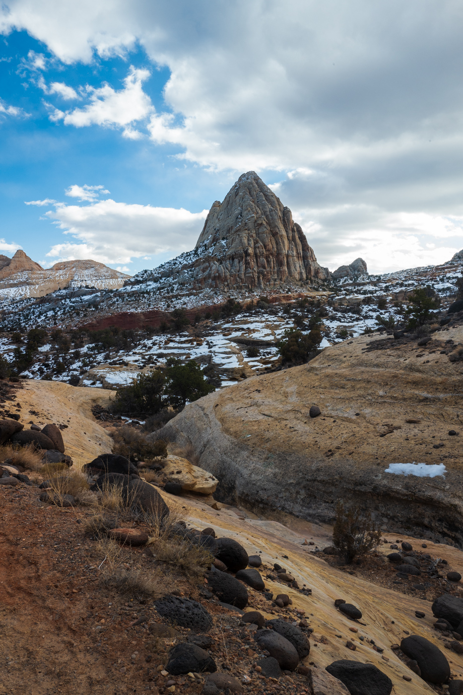
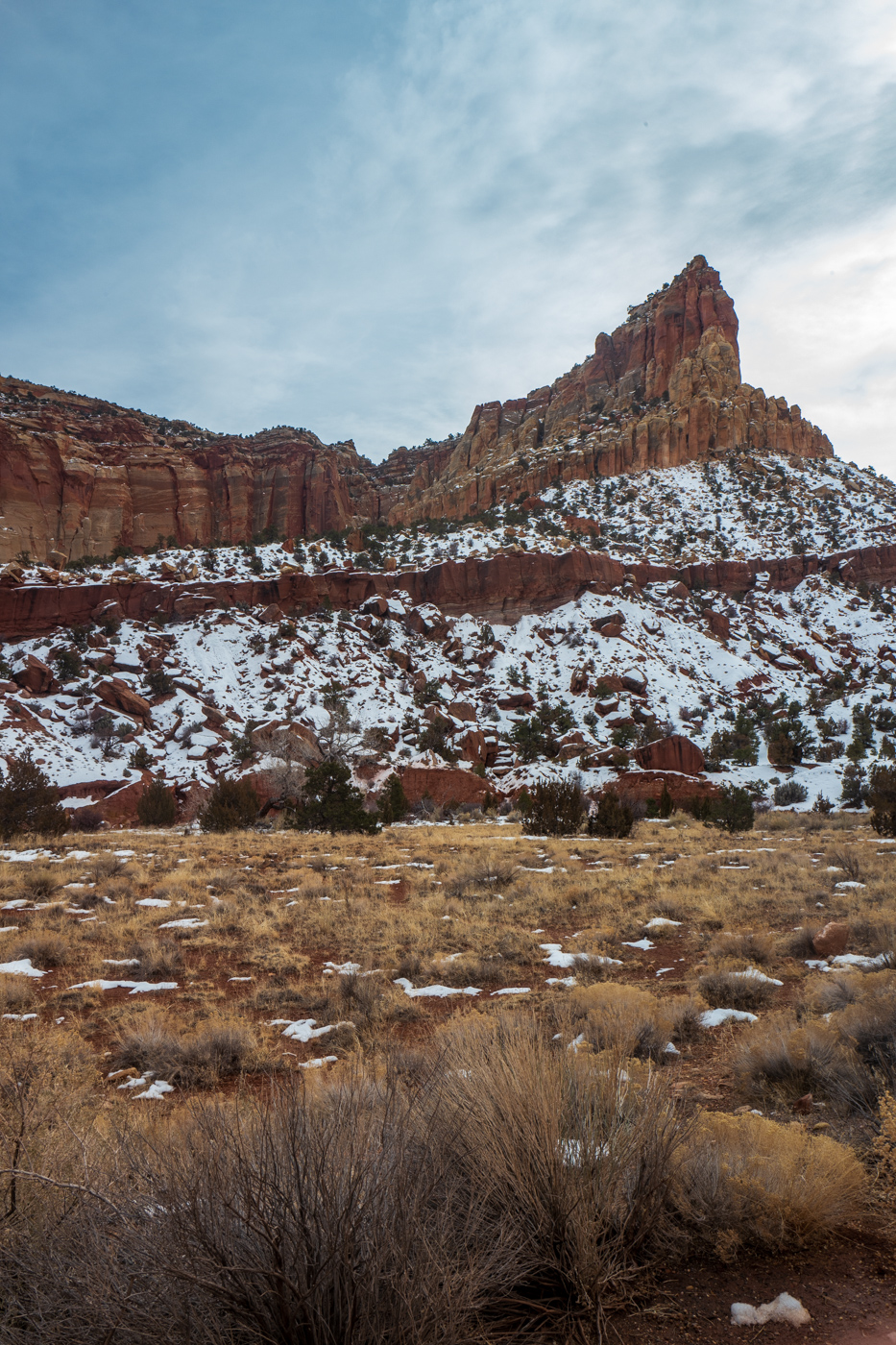
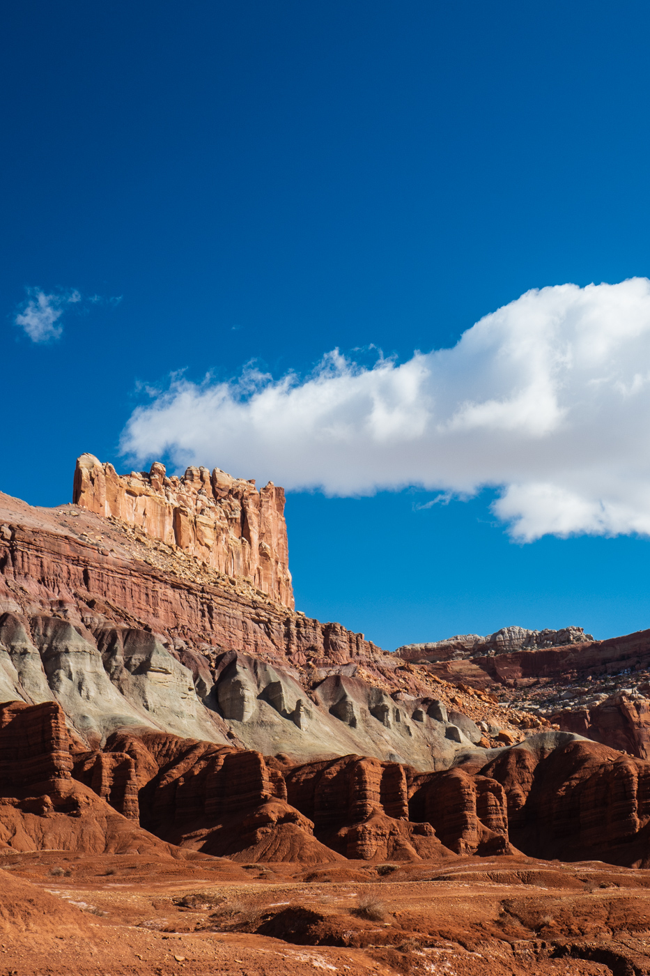
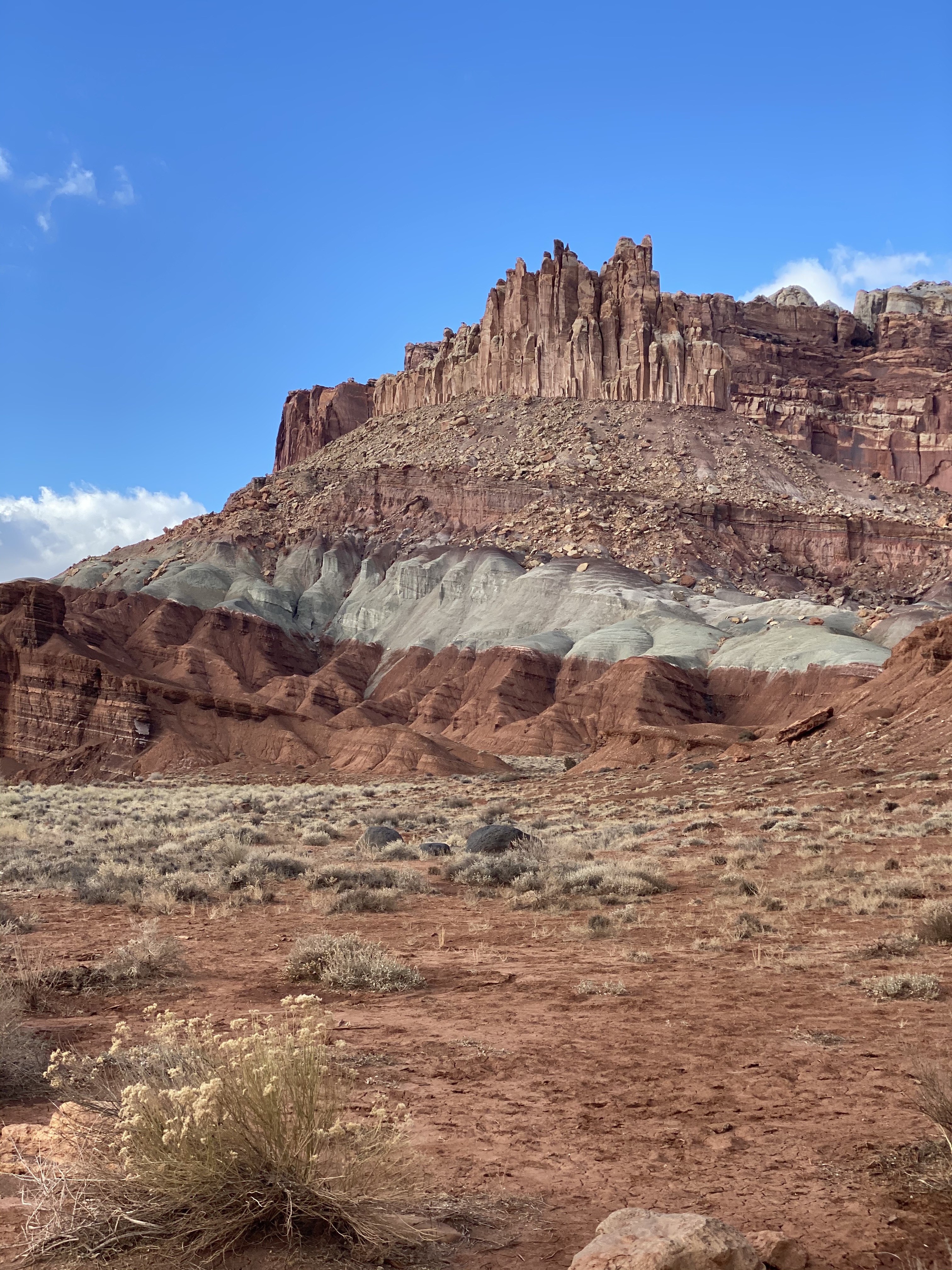
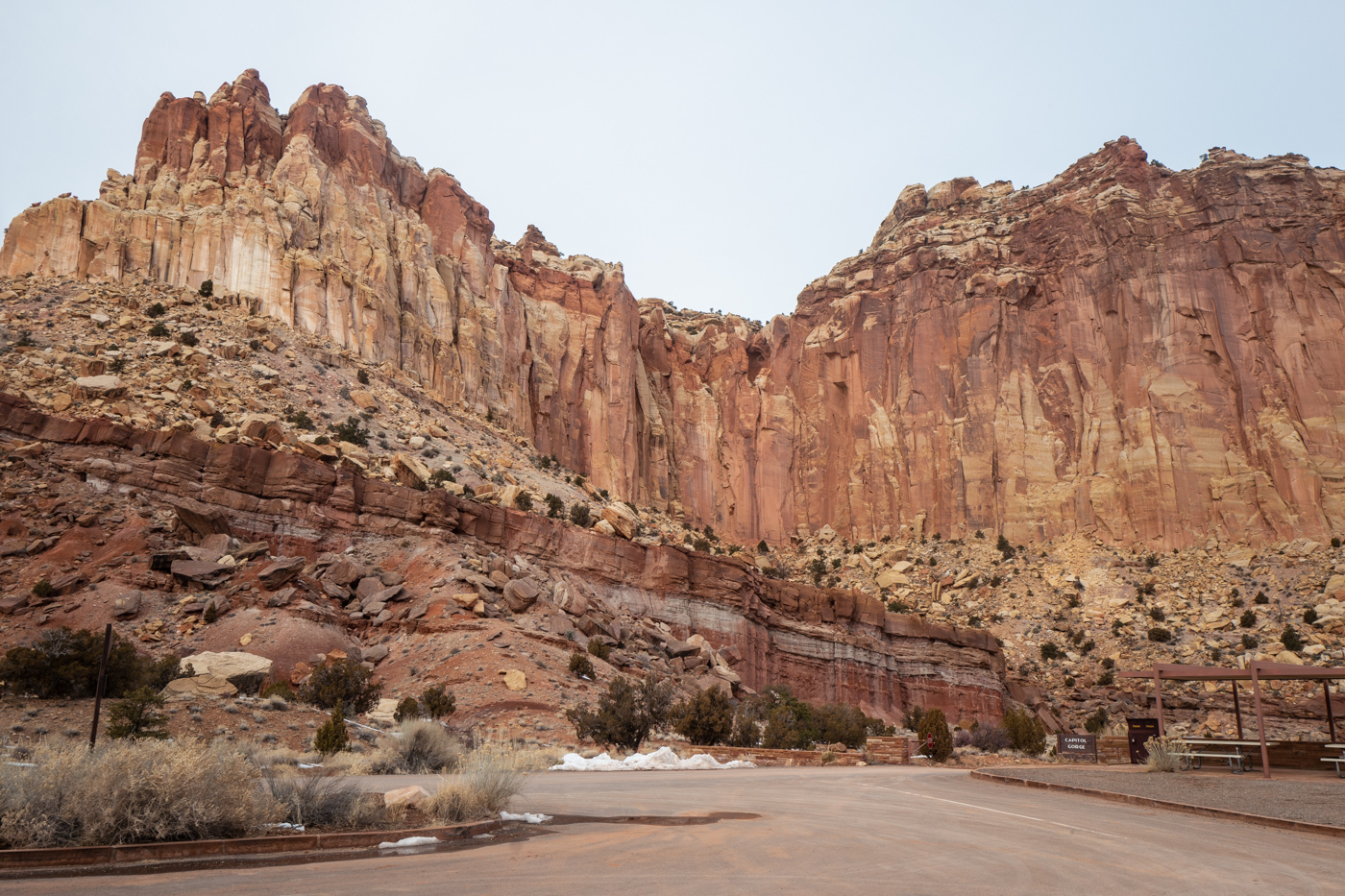
Capitol Reef
Capitol Reef is the least visited Utah National Park and isn’t far from Bryce. However, I wouldn’t recommend visiting in the winter. Spring or summer would be great.
In winter, a large section of the park is closed off due to washed out roads, and at least for the time I was there, the wind was flat out oppressive. Torrey (the only town nearby) is pretty dead during the off-season. The only breakfast option is to wait for the Subway inside the gas station to open, and there’s only one option for lunch and dinner (Red Cliff Restaurant, the food wasn’t bad!).
Capitol Reef is focused around the Waterpocket Fold - a 100 mile long sliver of land that was lifted up above everything around it. While that might not sound like enough of a reason to justify the trip, Capitol Reef is truly beautiful and doesn’t photograph as well as the other National or even State Parks in the state. Everyone who goes here says they wished they spent more time in the area, and I agree.
Comments